I05D Terrebonne, OR, USA - Earthquake Result Viewer
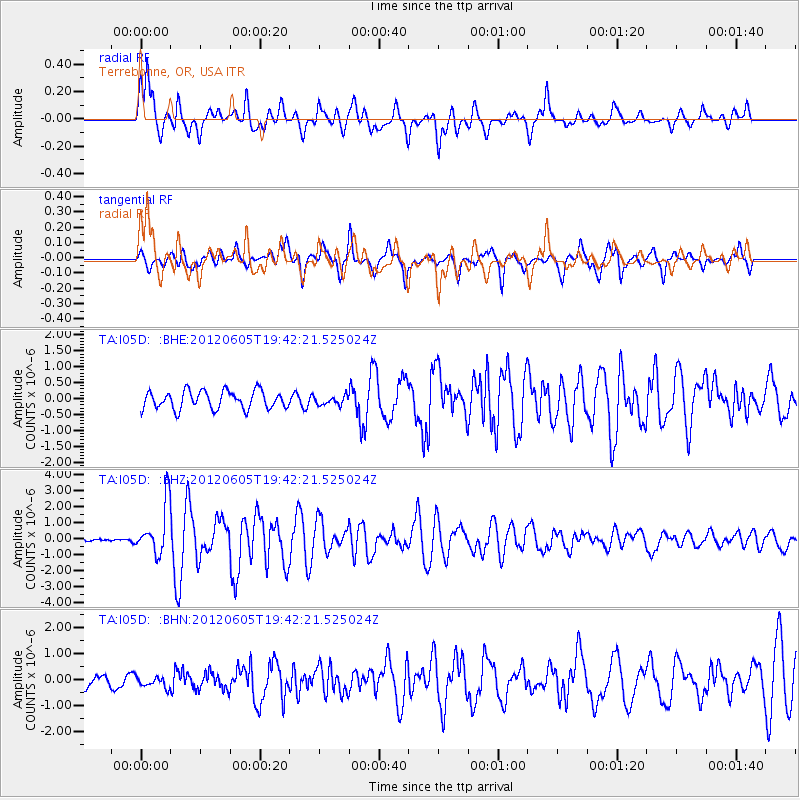
Earthquake location: Off East Coast Of Honshu, Japan
Earthquake latitude/longitude: 34.9/141.1
Earthquake time(UTC): 2012/06/05 (157) 19:31:33 GMT
Earthquake Depth: 15 km
Earthquake Magnitude: 6.2 MB, 6.0 MS, 6.1 MW, 6.1 MW
Earthquake Catalog/Contributor: WHDF/NEIC
Network: TA USArray Transportable Network (new EarthScope stations)
Station: I05D Terrebonne, OR, USA
Lat/Lon: 44.34 N/121.34 W
Elevation: 1546 m
Distance: 71.3 deg
Az: 48.662 deg
Baz: 300.727 deg
Ray Param: 0.054381214
Estimated Moho Depth: 11.75 km
Estimated Crust Vp/Vs: 1.63
Assumed Crust Vp: 6.597 km/s
Estimated Crust Vs: 4.054 km/s
Estimated Crust Poisson's Ratio: 0.20
Radial Match: 83.20523 %
Radial Bump: 400
Transverse Match: 77.52241 %
Transverse Bump: 400
SOD ConfigId: 458385
Insert Time: 2012-10-16 10:14:09.108 +0000
GWidth: 2.5
Max Bumps: 400
Tol: 0.001

Signal To Noise

ChannelStoNSTALTA
TA:I05D: :BHZ:20120605T19:42:21.525024Z4.97084861.5716744E-63.1617827E-7
TA:I05D: :BHN:20120605T19:42:21.525024Z0.619838242.1573972E-73.4805808E-7
TA:I05D: :BHE:20120605T19:42:21.525024Z0.496821171.4050221E-72.8280238E-7
Arrivals
Ps1.2 SECOND
PpPs4.5 SECOND
PsPs/PpSs5.7 SECOND