N02D Trinity Center, CA, USA - Earthquake Result Viewer
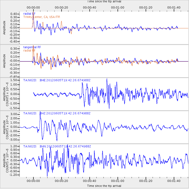
Earthquake location: Off East Coast Of Honshu, Japan
Earthquake latitude/longitude: 34.9/141.1
Earthquake time(UTC): 2012/06/05 (157) 19:31:33 GMT
Earthquake Depth: 15 km
Earthquake Magnitude: 6.2 MB, 6.0 MS, 6.1 MW, 6.1 MW
Earthquake Catalog/Contributor: WHDF/NEIC
Network: TA USArray Transportable Network (new EarthScope stations)
Station: N02D Trinity Center, CA, USA
Lat/Lon: 40.97 N/122.71 W
Elevation: 937 m
Distance: 72.2 deg
Az: 52.246 deg
Baz: 300.926 deg
Ray Param: 0.05380763
Estimated Moho Depth: 24.75 km
Estimated Crust Vp/Vs: 1.73
Assumed Crust Vp: 6.566 km/s
Estimated Crust Vs: 3.806 km/s
Estimated Crust Poisson's Ratio: 0.25
Radial Match: 88.925026 %
Radial Bump: 400
Transverse Match: 76.730705 %
Transverse Bump: 400
SOD ConfigId: 458385
Insert Time: 2012-10-16 10:14:54.103 +0000
GWidth: 2.5
Max Bumps: 400
Tol: 0.001

Signal To Noise

ChannelStoNSTALTA
TA:N02D: :BHZ:20120605T19:42:26.674988Z7.16411359.012416E-71.2579946E-7
TA:N02D: :BHN:20120605T19:42:26.674988Z1.66262352.4172246E-71.4538617E-7
TA:N02D: :BHE:20120605T19:42:26.674988Z2.9116933.0265483E-71.03944615E-7
Arrivals
Ps2.8 SECOND
PpPs9.9 SECOND
PsPs/PpSs13 SECOND