You are here: Home > Network List > TA - USArray Transportable Network (new EarthScope stations) Stations List
> Station 435B Jarrell, TX, USA > Earthquake Result Viewer
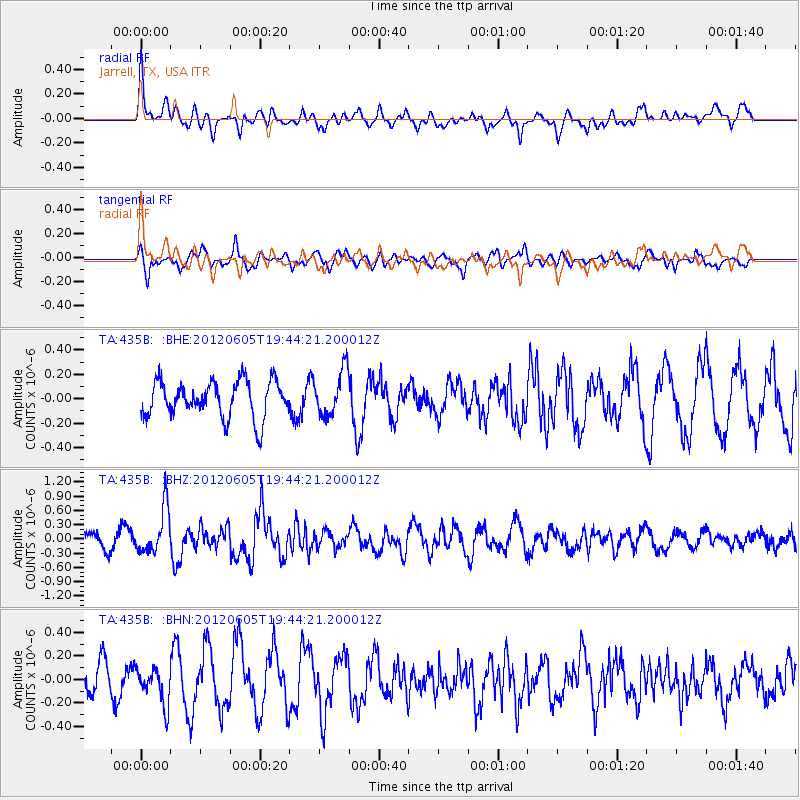
435B Jarrell, TX, USA - Earthquake Result Viewer
*The percent match for this event was below the threshold and hence no stack was calculated.
| Earthquake location: |
Off East Coast Of Honshu, Japan |
| Earthquake latitude/longitude: |
34.9/141.1 |
| Earthquake time(UTC): |
2012/06/05 (157) 19:31:33 GMT |
| Earthquake Depth: |
15 km |
| Earthquake Magnitude: |
6.2 MB, 6.0 MS, 6.1 MW, 6.1 MW |
| Earthquake Catalog/Contributor: |
WHDF/NEIC |
|
| Network: |
TA USArray Transportable Network (new EarthScope stations) |
| Station: |
435B Jarrell, TX, USA |
| Lat/Lon: |
30.78 N/97.58 W |
| Elevation: |
248 m |
|
| Distance: |
94.4 deg |
| Az: |
47.534 deg |
| Baz: |
315.238 deg |
| Ray Param: |
$rayparam |
*The percent match for this event was below the threshold and hence was not used in the summary stack. |
|
| Radial Match: |
63.126575 % |
| Radial Bump: |
400 |
| Transverse Match: |
74.24369 % |
| Transverse Bump: |
400 |
| SOD ConfigId: |
458385 |
| Insert Time: |
2012-10-16 10:15:39.661 +0000 |
| GWidth: |
2.5 |
| Max Bumps: |
400 |
| Tol: |
0.001 |
|
Signal To Noise
| Channel | StoN | STA | LTA |
| TA:435B: :BHZ:20120605T19:44:21.200012Z | 3.2634237 | 4.7732175E-7 | 1.4626411E-7 |
| TA:435B: :BHN:20120605T19:44:21.200012Z | 1.5296853 | 1.5109461E-7 | 9.877496E-8 |
| TA:435B: :BHE:20120605T19:44:21.200012Z | 1.2334269 | 1.8242628E-7 | 1.4790197E-7 |
| Arrivals |
| Ps | |
| PpPs | |
| PsPs/PpSs | |


