
O03D Paynes Creek, CA, USA - Earthquake Result Viewer
| ||||||||||||||||||
| ||||||||||||||||||
| ||||||||||||||||||
|
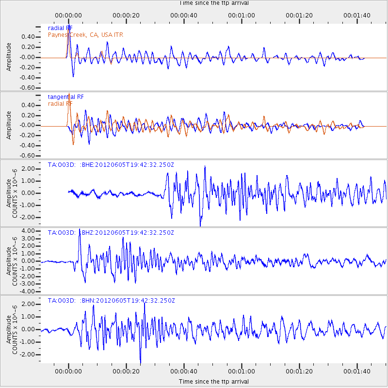
Signal To Noise
| Channel | StoN | STA | LTA |
| TA:O03D: :BHZ:20120605T19:42:32.250Z | 11.9191265 | 1.2856714E-6 | 1.0786624E-7 |
| TA:O03D: :BHN:20120605T19:42:32.250Z | 3.032415 | 4.1201525E-7 | 1.3587034E-7 |
| TA:O03D: :BHE:20120605T19:42:32.250Z | 4.161846 | 6.048086E-7 | 1.4532218E-7 |
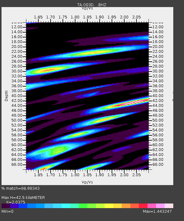
| Arrivals | |
| Ps | 6.9 SECOND |
| PpPs | 19 SECOND |
| PsPs/PpSs | 26 SECOND |

