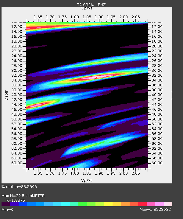
G32A Webster, SD, USA - Earthquake Result Viewer
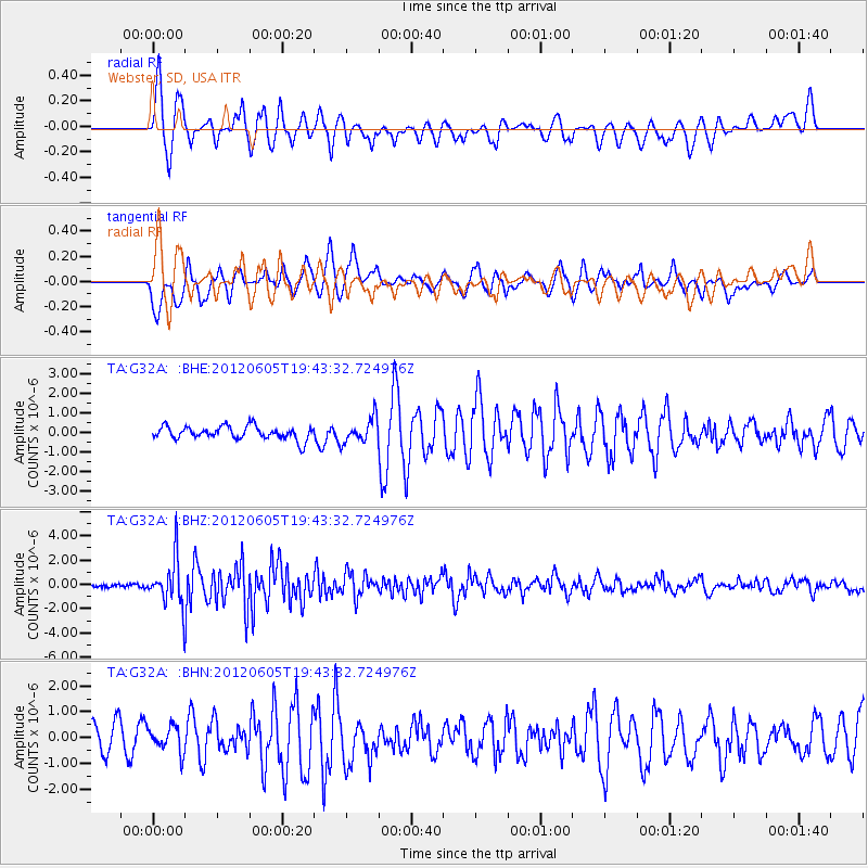
Earthquake location: Off East Coast Of Honshu, Japan
Earthquake latitude/longitude: 34.9/141.1
Earthquake time(UTC): 2012/06/05 (157) 19:31:33 GMT
Earthquake Depth: 15 km
Earthquake Magnitude: 6.2 MB, 6.0 MS, 6.1 MW, 6.1 MW
Earthquake Catalog/Contributor: WHDF/NEIC
Network: TA USArray Transportable Network (new EarthScope stations)
Station: G32A Webster, SD, USA
Lat/Lon: 45.26 N/97.50 W
Elevation: 566 m
Distance: 84.2 deg
Az: 37.317 deg
Baz: 315.163 deg
Ray Param: 0.045662567
Estimated Moho Depth: 32.5 km
Estimated Crust Vp/Vs: 1.89
Assumed Crust Vp: 6.552 km/s
Estimated Crust Vs: 3.471 km/s
Estimated Crust Poisson's Ratio: 0.30
Radial Match: 83.5505 %
Radial Bump: 400
Transverse Match: 80.829865 %
Transverse Bump: 400
SOD ConfigId: 458385
Insert Time: 2012-10-16 10:21:30.919 +0000
GWidth: 2.5
Max Bumps: 400
Tol: 0.001

Signal To Noise

ChannelStoNSTALTA
TA:G32A: :BHZ:20120605T19:43:32.724976Z13.0046461.9073015E-61.4666308E-7
TA:G32A: :BHN:20120605T19:43:32.724976Z0.960916944.980262E-75.182823E-7
TA:G32A: :BHE:20120605T19:43:32.724976Z1.84791146.2360147E-73.374629E-7
Arrivals
Ps4.5 SECOND
PpPs14 SECOND
PsPs/PpSs18 SECOND