You are here: Home > Network List > AZ - ANZA Regional Network Stations List
> Station FRD AZ.FRD > Earthquake Result Viewer
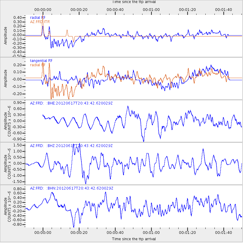
FRD AZ.FRD - Earthquake Result Viewer
*The percent match for this event was below the threshold and hence no stack was calculated.
| Earthquake location: |
Near East Coast Of Honshu, Japan |
| Earthquake latitude/longitude: |
38.9/141.8 |
| Earthquake time(UTC): |
2012/06/17 (169) 20:32:20 GMT |
| Earthquake Depth: |
36 km |
| Earthquake Magnitude: |
6.0 MB, 5.9 MS, 6.3 MW, 6.4 MW |
| Earthquake Catalog/Contributor: |
WHDF/NEIC |
|
| Network: |
AZ ANZA Regional Network |
| Station: |
FRD AZ.FRD |
| Lat/Lon: |
33.49 N/116.60 W |
| Elevation: |
1164 m |
|
| Distance: |
77.7 deg |
| Az: |
56.918 deg |
| Baz: |
308.538 deg |
| Ray Param: |
$rayparam |
*The percent match for this event was below the threshold and hence was not used in the summary stack. |
|
| Radial Match: |
56.451427 % |
| Radial Bump: |
400 |
| Transverse Match: |
42.235973 % |
| Transverse Bump: |
400 |
| SOD ConfigId: |
460165 |
| Insert Time: |
2013-02-11 20:52:10.092 +0000 |
| GWidth: |
2.5 |
| Max Bumps: |
400 |
| Tol: |
0.001 |
|
Signal To Noise
| Channel | StoN | STA | LTA |
| AZ:FRD: :BHZ:20120617T20:43:42.620029Z | 7.2838655 | 4.6681856E-7 | 6.40894E-8 |
| AZ:FRD: :BHN:20120617T20:43:42.620029Z | 2.1829648 | 5.7576966E-7 | 2.6375582E-7 |
| AZ:FRD: :BHE:20120617T20:43:42.620029Z | 1.7752938 | 3.0675255E-7 | 1.7278974E-7 |
| Arrivals |
| Ps | |
| PpPs | |
| PsPs/PpSs | |


