You are here: Home > Network List > AZ - ANZA Regional Network Stations List
> Station SMER AZ.SMER > Earthquake Result Viewer
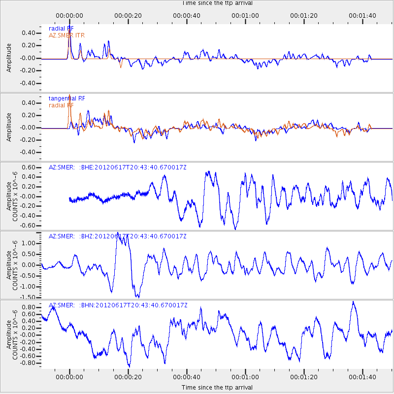
SMER AZ.SMER - Earthquake Result Viewer
*The percent match for this event was below the threshold and hence no stack was calculated.
| Earthquake location: |
Near East Coast Of Honshu, Japan |
| Earthquake latitude/longitude: |
38.9/141.8 |
| Earthquake time(UTC): |
2012/06/17 (169) 20:32:20 GMT |
| Earthquake Depth: |
36 km |
| Earthquake Magnitude: |
6.0 MB, 5.9 MS, 6.3 MW, 6.4 MW |
| Earthquake Catalog/Contributor: |
WHDF/NEIC |
|
| Network: |
AZ ANZA Regional Network |
| Station: |
SMER AZ.SMER |
| Lat/Lon: |
33.46 N/117.17 W |
| Elevation: |
355 m |
|
| Distance: |
77.4 deg |
| Az: |
57.25 deg |
| Baz: |
308.298 deg |
| Ray Param: |
$rayparam |
*The percent match for this event was below the threshold and hence was not used in the summary stack. |
|
| Radial Match: |
66.425514 % |
| Radial Bump: |
400 |
| Transverse Match: |
29.695158 % |
| Transverse Bump: |
400 |
| SOD ConfigId: |
460165 |
| Insert Time: |
2013-02-11 20:52:37.326 +0000 |
| GWidth: |
2.5 |
| Max Bumps: |
400 |
| Tol: |
0.001 |
|
Signal To Noise
| Channel | StoN | STA | LTA |
| AZ:SMER: :BHZ:20120617T20:43:40.670017Z | 2.7330313 | 2.810429E-7 | 1.0283194E-7 |
| AZ:SMER: :BHN:20120617T20:43:40.670017Z | 0.43842477 | 2.0682135E-7 | 4.717374E-7 |
| AZ:SMER: :BHE:20120617T20:43:40.670017Z | 4.223046 | 2.3290245E-7 | 5.515035E-8 |
| Arrivals |
| Ps | |
| PpPs | |
| PsPs/PpSs | |


