You are here: Home > Network List > US - United States National Seismic Network Stations List
> Station HAWA Hanford, Washington, USA > Earthquake Result Viewer
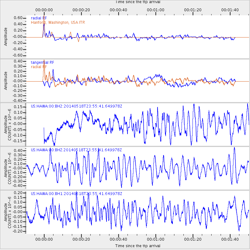
HAWA Hanford, Washington, USA - Earthquake Result Viewer
*The percent match for this event was below the threshold and hence no stack was calculated.
| Earthquake location: |
Central East Pacific Rise |
| Earthquake latitude/longitude: |
-4.5/-106.0 |
| Earthquake time(UTC): |
2014/05/18 (138) 23:47:04 GMT |
| Earthquake Depth: |
17 km |
| Earthquake Magnitude: |
5.9 MW |
| Earthquake Catalog/Contributor: |
ISC/ISC |
|
| Network: |
US United States National Seismic Network |
| Station: |
HAWA Hanford, Washington, USA |
| Lat/Lon: |
46.39 N/119.53 W |
| Elevation: |
364 m |
|
| Distance: |
52.0 deg |
| Az: |
348.162 deg |
| Baz: |
162.812 deg |
| Ray Param: |
$rayparam |
*The percent match for this event was below the threshold and hence was not used in the summary stack. |
|
| Radial Match: |
61.31272 % |
| Radial Bump: |
400 |
| Transverse Match: |
58.114365 % |
| Transverse Bump: |
400 |
| SOD ConfigId: |
3390531 |
| Insert Time: |
2019-04-11 23:10:12.511 +0000 |
| GWidth: |
2.5 |
| Max Bumps: |
400 |
| Tol: |
0.001 |
|
Signal To Noise
| Channel | StoN | STA | LTA |
| US:HAWA:00:BHZ:20140518T23:55:41.649978Z | 3.0536523 | 1.7663402E-7 | 5.7843522E-8 |
| US:HAWA:00:BH1:20140518T23:55:41.649978Z | 1.1915523 | 6.306886E-8 | 5.2929995E-8 |
| US:HAWA:00:BH2:20140518T23:55:41.649978Z | 0.42898443 | 3.3646412E-8 | 7.843271E-8 |
| Arrivals |
| Ps | |
| PpPs | |
| PsPs/PpSs | |


