You are here: Home > Network List > CI - Caltech Regional Seismic Network Stations List
> Station MPP McPhearson Peak > Earthquake Result Viewer
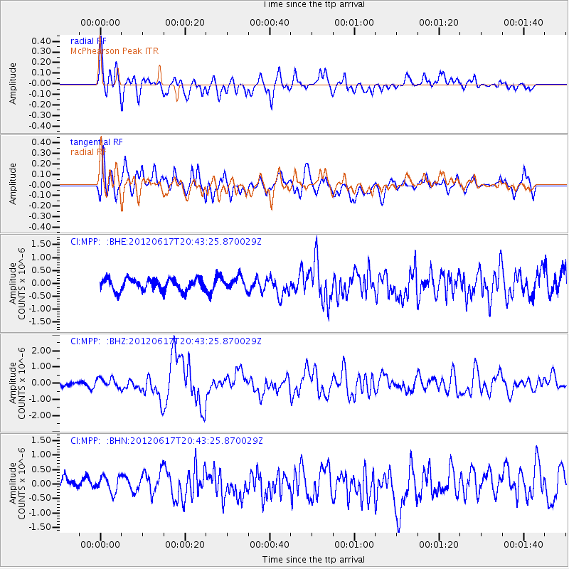
MPP McPhearson Peak - Earthquake Result Viewer
*The percent match for this event was below the threshold and hence no stack was calculated.
| Earthquake location: |
Near East Coast Of Honshu, Japan |
| Earthquake latitude/longitude: |
38.9/141.8 |
| Earthquake time(UTC): |
2012/06/17 (169) 20:32:20 GMT |
| Earthquake Depth: |
36 km |
| Earthquake Magnitude: |
6.0 MB, 5.9 MS, 6.3 MW, 6.4 MW |
| Earthquake Catalog/Contributor: |
WHDF/NEIC |
|
| Network: |
CI Caltech Regional Seismic Network |
| Station: |
MPP McPhearson Peak |
| Lat/Lon: |
34.89 N/119.81 W |
| Elevation: |
1739 m |
|
| Distance: |
74.7 deg |
| Az: |
57.462 deg |
| Baz: |
306.871 deg |
| Ray Param: |
$rayparam |
*The percent match for this event was below the threshold and hence was not used in the summary stack. |
|
| Radial Match: |
64.63904 % |
| Radial Bump: |
400 |
| Transverse Match: |
71.920715 % |
| Transverse Bump: |
400 |
| SOD ConfigId: |
460165 |
| Insert Time: |
2013-02-11 20:56:29.313 +0000 |
| GWidth: |
2.5 |
| Max Bumps: |
400 |
| Tol: |
0.001 |
|
Signal To Noise
| Channel | StoN | STA | LTA |
| CI:MPP: :BHZ:20120617T20:43:25.870029Z | 2.5006523 | 2.970979E-7 | 1.1880816E-7 |
| CI:MPP: :BHN:20120617T20:43:25.870029Z | 0.8304079 | 3.260099E-7 | 3.925901E-7 |
| CI:MPP: :BHE:20120617T20:43:25.870029Z | 1.0609753 | 2.4237883E-7 | 2.2844908E-7 |
| Arrivals |
| Ps | |
| PpPs | |
| PsPs/PpSs | |


