You are here: Home > Network List > IU - Global Seismograph Network (GSN - IRIS/USGS) Stations List
> Station RSSD Black Hills, South Dakota, USA > Earthquake Result Viewer
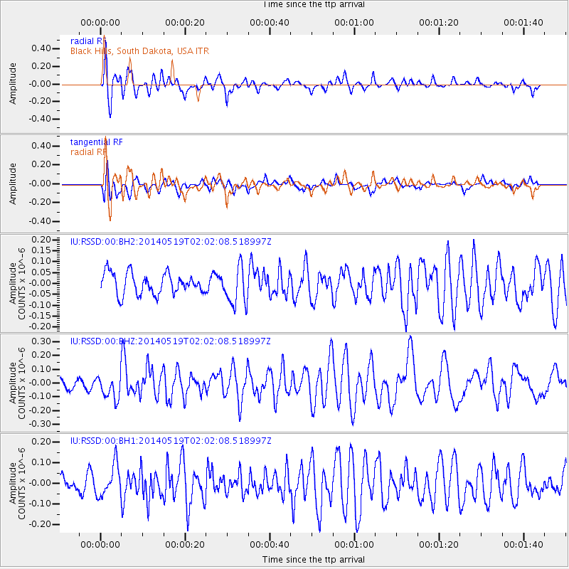
RSSD Black Hills, South Dakota, USA - Earthquake Result Viewer
*The percent match for this event was below the threshold and hence no stack was calculated.
| Earthquake location: |
Central East Pacific Rise |
| Earthquake latitude/longitude: |
-4.8/-105.5 |
| Earthquake time(UTC): |
2014/05/19 (139) 01:53:54 GMT |
| Earthquake Depth: |
10 km |
| Earthquake Magnitude: |
5.5 MWB, 5.6 MWC |
| Earthquake Catalog/Contributor: |
NEIC PDE/NEIC COMCAT |
|
| Network: |
IU Global Seismograph Network (GSN - IRIS/USGS) |
| Station: |
RSSD Black Hills, South Dakota, USA |
| Lat/Lon: |
44.12 N/104.04 W |
| Elevation: |
2090 m |
|
| Distance: |
48.7 deg |
| Az: |
1.45 deg |
| Baz: |
182.006 deg |
| Ray Param: |
$rayparam |
*The percent match for this event was below the threshold and hence was not used in the summary stack. |
|
| Radial Match: |
72.21919 % |
| Radial Bump: |
400 |
| Transverse Match: |
59.989162 % |
| Transverse Bump: |
400 |
| SOD ConfigId: |
3390531 |
| Insert Time: |
2019-04-11 23:14:56.510 +0000 |
| GWidth: |
2.5 |
| Max Bumps: |
400 |
| Tol: |
0.001 |
|
Signal To Noise
| Channel | StoN | STA | LTA |
| IU:RSSD:00:BHZ:20140519T02:02:08.518997Z | 1.042352 | 9.30688E-8 | 8.928731E-8 |
| IU:RSSD:00:BH1:20140519T02:02:08.518997Z | 1.8368948 | 7.8368615E-8 | 4.266364E-8 |
| IU:RSSD:00:BH2:20140519T02:02:08.518997Z | 1.6501489 | 7.9455376E-8 | 4.815043E-8 |
| Arrivals |
| Ps | |
| PpPs | |
| PsPs/PpSs | |


