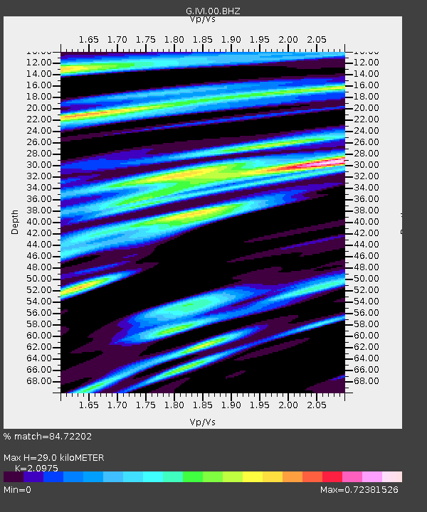
IVI Ivittuut, Greenland - Earthquake Result Viewer
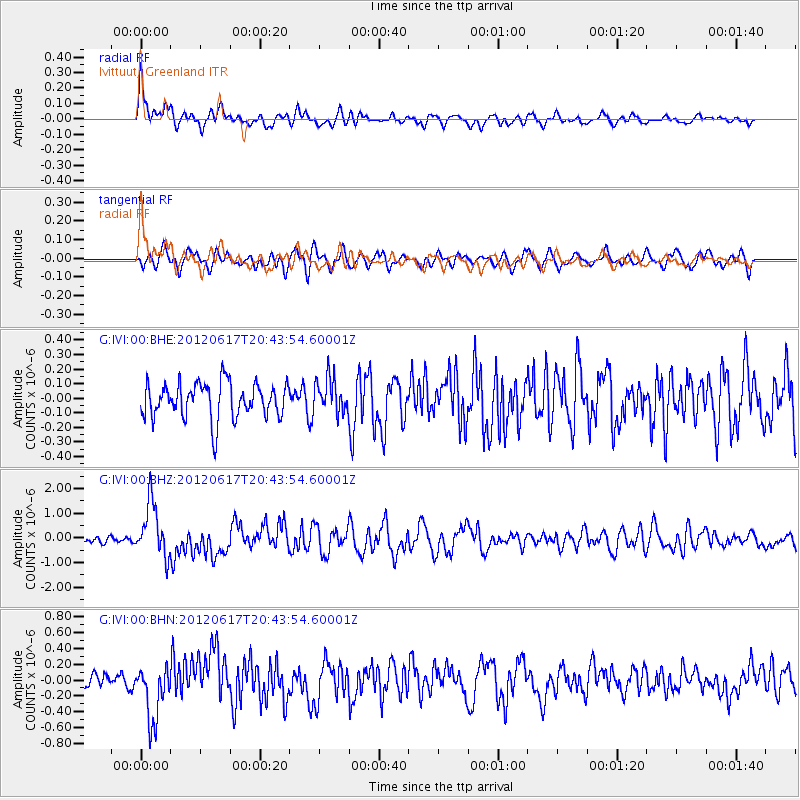
Earthquake location: Near East Coast Of Honshu, Japan
Earthquake latitude/longitude: 38.9/141.8
Earthquake time(UTC): 2012/06/17 (169) 20:32:20 GMT
Earthquake Depth: 36 km
Earthquake Magnitude: 6.0 MB, 5.9 MS, 6.3 MW, 6.4 MW
Earthquake Catalog/Contributor: WHDF/NEIC
Network: G GEOSCOPE
Station: IVI Ivittuut, Greenland
Lat/Lon: 61.21 N/48.17 W
Elevation: 15 m
Distance: 79.9 deg
Az: 4.9 deg
Baz: 352.089 deg
Ray Param: 0.048597984
Estimated Moho Depth: 29.0 km
Estimated Crust Vp/Vs: 2.10
Assumed Crust Vp: 6.472 km/s
Estimated Crust Vs: 3.086 km/s
Estimated Crust Poisson's Ratio: 0.35
Radial Match: 84.72202 %
Radial Bump: 400
Transverse Match: 67.6904 %
Transverse Bump: 400
SOD ConfigId: 460165
Insert Time: 2013-02-11 20:58:56.824 +0000
GWidth: 2.5
Max Bumps: 400
Tol: 0.001

Signal To Noise

ChannelStoNSTALTA
G:IVI:00:BHZ:20120617T20:43:54.60001Z12.5377351.0912087E-68.703396E-8
G:IVI:00:BHN:20120617T20:43:54.60001Z4.03419883.5637737E-78.8339064E-8
G:IVI:00:BHE:20120617T20:43:54.60001Z0.97267181.185154E-71.2184522E-7
Arrivals
Ps5.0 SECOND
PpPs14 SECOND
PsPs/PpSs19 SECOND