
T25A Trinidad, CO, USA - Earthquake Result Viewer
| ||||||||||||||||||
| ||||||||||||||||||
| ||||||||||||||||||
|
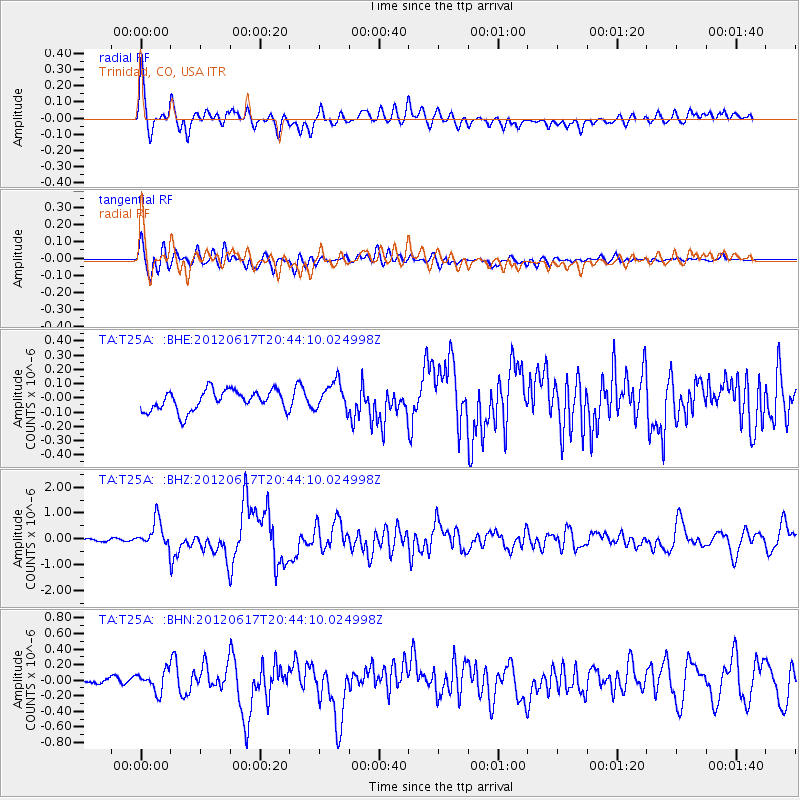
Signal To Noise
| Channel | StoN | STA | LTA |
| TA:T25A: :BHZ:20120617T20:44:10.024998Z | 12.418341 | 5.1670855E-7 | 4.16085E-8 |
| TA:T25A: :BHN:20120617T20:44:10.024998Z | 2.9994333 | 1.3195854E-7 | 4.3994497E-8 |
| TA:T25A: :BHE:20120617T20:44:10.024998Z | 1.381147 | 9.998909E-8 | 7.2395686E-8 |
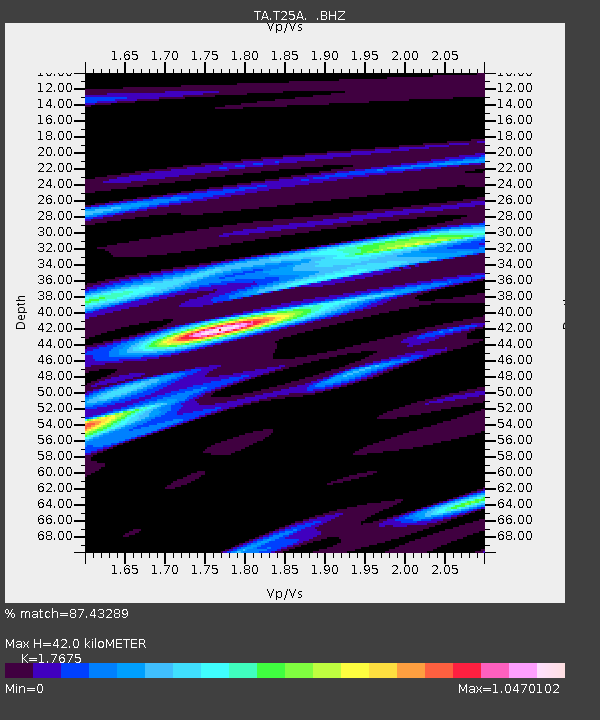
| Arrivals | |
| Ps | 5.2 SECOND |
| PpPs | 18 SECOND |
| PsPs/PpSs | 23 SECOND |

