
TUL1 Leonard, OK, USA - Earthquake Result Viewer
| ||||||||||||||||||
| ||||||||||||||||||
| ||||||||||||||||||
|
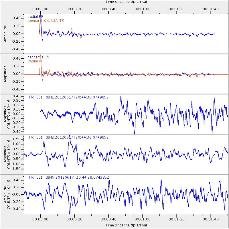
Signal To Noise
| Channel | StoN | STA | LTA |
| TA:TUL1: :BHZ:20120617T20:44:38.074985Z | 7.569549 | 5.769093E-7 | 7.621449E-8 |
| TA:TUL1: :BHN:20120617T20:44:38.074985Z | 3.4251533 | 1.7442157E-7 | 5.092373E-8 |
| TA:TUL1: :BHE:20120617T20:44:38.074985Z | 2.1466076 | 1.1650925E-7 | 5.4275986E-8 |
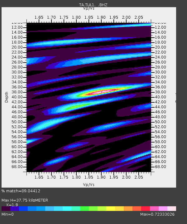
| Arrivals | |
| Ps | 5.3 SECOND |
| PpPs | 17 SECOND |
| PsPs/PpSs | 22 SECOND |

