E31A Nome, ND, USA - Earthquake Result Viewer
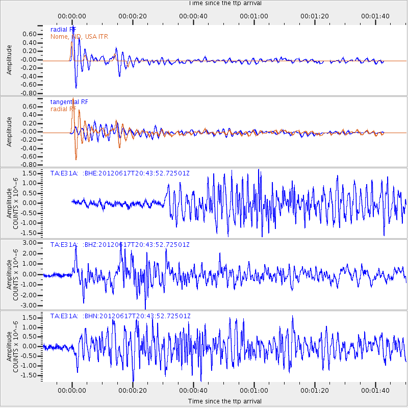
Earthquake location: Near East Coast Of Honshu, Japan
Earthquake latitude/longitude: 38.9/141.8
Earthquake time(UTC): 2012/06/17 (169) 20:32:20 GMT
Earthquake Depth: 36 km
Earthquake Magnitude: 6.0 MB, 5.9 MS, 6.3 MW, 6.4 MW
Earthquake Catalog/Contributor: WHDF/NEIC
Network: TA USArray Transportable Network (new EarthScope stations)
Station: E31A Nome, ND, USA
Lat/Lon: 46.56 N/97.89 W
Elevation: 427 m
Distance: 79.5 deg
Az: 37.297 deg
Baz: 316.763 deg
Ray Param: 0.048832744
Estimated Moho Depth: 14.0 km
Estimated Crust Vp/Vs: 2.10
Assumed Crust Vp: 6.498 km/s
Estimated Crust Vs: 3.098 km/s
Estimated Crust Poisson's Ratio: 0.35
Radial Match: 94.3267 %
Radial Bump: 400
Transverse Match: 86.416084 %
Transverse Bump: 400
SOD ConfigId: 460165
Insert Time: 2013-02-11 21:11:14.790 +0000
GWidth: 2.5
Max Bumps: 400
Tol: 0.001

Signal To Noise

ChannelStoNSTALTA
TA:E31A: :BHZ:20120617T20:43:52.72501Z14.3965011.1106324E-67.7146E-8
TA:E31A: :BHN:20120617T20:43:52.72501Z5.15491635.270607E-71.0224428E-7
TA:E31A: :BHE:20120617T20:43:52.72501Z5.3014295.457169E-71.029377E-7
Arrivals
Ps2.4 SECOND
PpPs6.5 SECOND
PsPs/PpSs8.9 SECOND