
D36A Goodland, MN, USA - Earthquake Result Viewer
| ||||||||||||||||||
| ||||||||||||||||||
| ||||||||||||||||||
|
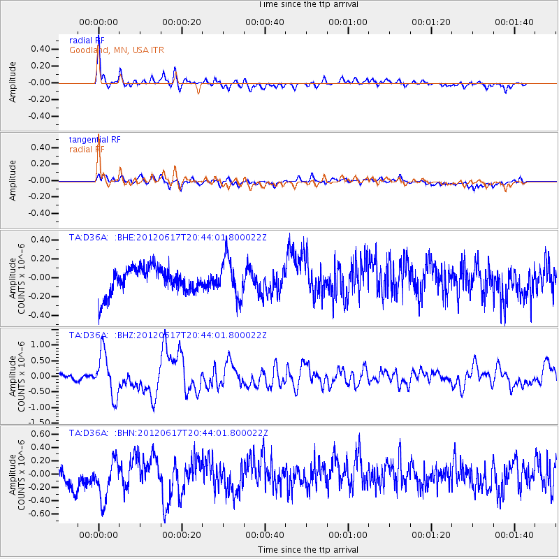
Signal To Noise
| Channel | StoN | STA | LTA |
| TA:D36A: :BHZ:20120617T20:44:01.800022Z | 10.078439 | 7.1475336E-7 | 7.091905E-8 |
| TA:D36A: :BHN:20120617T20:44:01.800022Z | 2.1331906 | 3.214689E-7 | 1.5069863E-7 |
| TA:D36A: :BHE:20120617T20:44:01.800022Z | 1.5634656 | 2.0998044E-7 | 1.3430449E-7 |
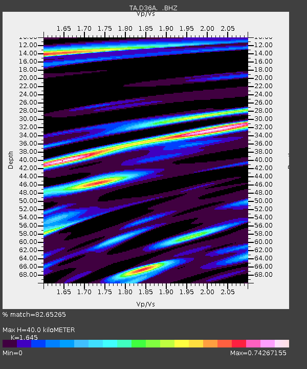
| Arrivals | |
| Ps | 4.0 SECOND |
| PpPs | 16 SECOND |
| PsPs/PpSs | 20 SECOND |

