D37A Cotton, MN, USA - Earthquake Result Viewer
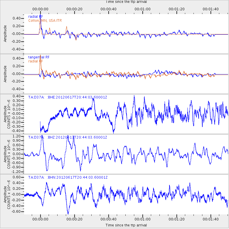
Earthquake location: Near East Coast Of Honshu, Japan
Earthquake latitude/longitude: 38.9/141.8
Earthquake time(UTC): 2012/06/17 (169) 20:32:20 GMT
Earthquake Depth: 36 km
Earthquake Magnitude: 6.0 MB, 5.9 MS, 6.3 MW, 6.4 MW
Earthquake Catalog/Contributor: WHDF/NEIC
Network: TA USArray Transportable Network (new EarthScope stations)
Station: D37A Cotton, MN, USA
Lat/Lon: 47.16 N/92.43 W
Elevation: 413 m
Distance: 81.6 deg
Az: 34.05 deg
Baz: 320.204 deg
Ray Param: 0.047432024
Estimated Moho Depth: 36.0 km
Estimated Crust Vp/Vs: 1.94
Assumed Crust Vp: 6.571 km/s
Estimated Crust Vs: 3.383 km/s
Estimated Crust Poisson's Ratio: 0.32
Radial Match: 85.97592 %
Radial Bump: 400
Transverse Match: 50.46504 %
Transverse Bump: 400
SOD ConfigId: 460165
Insert Time: 2013-02-11 21:12:38.007 +0000
GWidth: 2.5
Max Bumps: 400
Tol: 0.001

Signal To Noise

ChannelStoNSTALTA
TA:D37A: :BHZ:20120617T20:44:03.60001Z9.9498387.407128E-77.4444706E-8
TA:D37A: :BHN:20120617T20:44:03.60001Z3.89418772.3335106E-75.992291E-8
TA:D37A: :BHE:20120617T20:44:03.60001Z1.3614092.2200953E-71.6307337E-7
Arrivals
Ps5.3 SECOND
PpPs16 SECOND
PsPs/PpSs21 SECOND