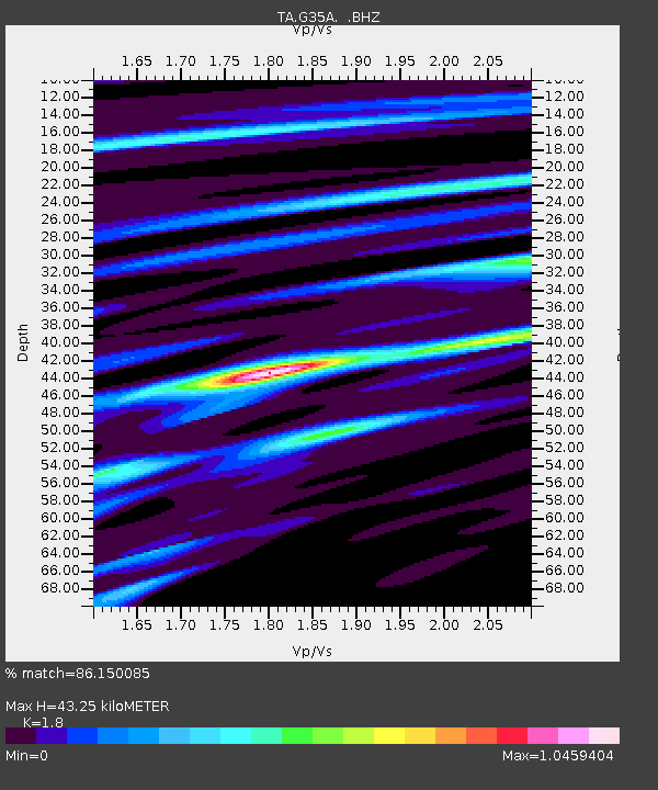
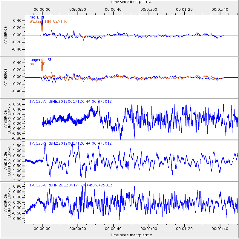
G35A Watkins, MN, USA - Earthquake Result Viewer

Earthquake location: Near East Coast Of Honshu, Japan
Earthquake latitude/longitude: 38.9/141.8
Earthquake time(UTC): 2012/06/17 (169) 20:32:20 GMT
Earthquake Depth: 36 km
Earthquake Magnitude: 6.0 MB, 5.9 MS, 6.3 MW, 6.4 MW
Earthquake Catalog/Contributor: WHDF/NEIC
Network: TA USArray Transportable Network (new EarthScope stations)
Station: G35A Watkins, MN, USA
Lat/Lon: 45.22 N/94.49 W
Elevation: 361 m
Distance: 82.1 deg
Az: 36.42 deg
Baz: 319.058 deg
Ray Param: 0.047046907
Estimated Moho Depth: 43.25 km
Estimated Crust Vp/Vs: 1.80
Assumed Crust Vp: 6.571 km/s
Estimated Crust Vs: 3.65 km/s
Estimated Crust Poisson's Ratio: 0.28
Radial Match: 86.150085 %
Radial Bump: 400
Transverse Match: 54.105705 %
Transverse Bump: 400
SOD ConfigId: 460165
Insert Time: 2013-02-11 21:13:18.532 +0000
GWidth: 2.5
Max Bumps: 400
Tol: 0.001

Signal To Noise

ChannelStoNSTALTA
TA:G35A: :BHZ:20120617T20:44:06.47501Z9.7994628.6499307E-78.8269445E-8
TA:G35A: :BHN:20120617T20:44:06.47501Z1.54959072.9222724E-71.8858351E-7
TA:G35A: :BHE:20120617T20:44:06.47501Z3.14204653.4280168E-71.09101414E-7
Arrivals
Ps5.4 SECOND
PpPs18 SECOND
PsPs/PpSs23 SECOND