K37A Belmond, IA, USA - Earthquake Result Viewer
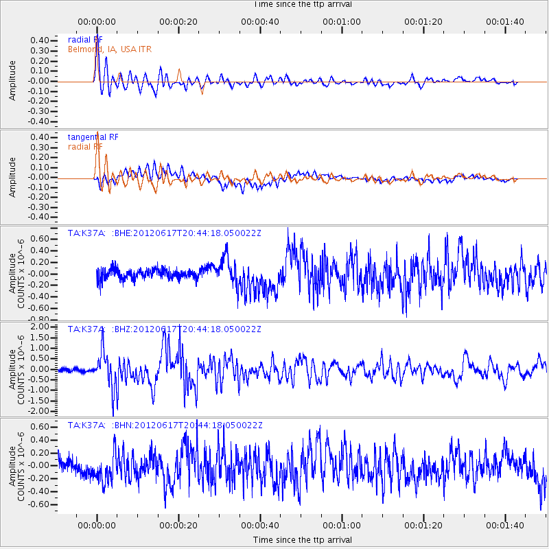
Earthquake location: Near East Coast Of Honshu, Japan
Earthquake latitude/longitude: 38.9/141.8
Earthquake time(UTC): 2012/06/17 (169) 20:32:20 GMT
Earthquake Depth: 36 km
Earthquake Magnitude: 6.0 MB, 5.9 MS, 6.3 MW, 6.4 MW
Earthquake Catalog/Contributor: WHDF/NEIC
Network: TA USArray Transportable Network (new EarthScope stations)
Station: K37A Belmond, IA, USA
Lat/Lon: 42.77 N/93.64 W
Elevation: 365 m
Distance: 84.4 deg
Az: 37.559 deg
Baz: 319.778 deg
Ray Param: 0.04546369
Estimated Moho Depth: 20.25 km
Estimated Crust Vp/Vs: 1.75
Assumed Crust Vp: 6.53 km/s
Estimated Crust Vs: 3.721 km/s
Estimated Crust Poisson's Ratio: 0.26
Radial Match: 87.32168 %
Radial Bump: 400
Transverse Match: 75.38362 %
Transverse Bump: 400
SOD ConfigId: 460165
Insert Time: 2013-02-11 21:14:50.384 +0000
GWidth: 2.5
Max Bumps: 400
Tol: 0.001

Signal To Noise

ChannelStoNSTALTA
TA:K37A: :BHZ:20120617T20:44:18.050022Z11.932558.5131524E-77.134395E-8
TA:K37A: :BHN:20120617T20:44:18.050022Z1.9482252.3092028E-71.1852854E-7
TA:K37A: :BHE:20120617T20:44:18.050022Z2.9326092.3930215E-78.1600426E-8
Arrivals
Ps2.4 SECOND
PpPs8.3 SECOND
PsPs/PpSs11 SECOND