
O38A Galt, MO, USA - Earthquake Result Viewer
| ||||||||||||||||||
| ||||||||||||||||||
| ||||||||||||||||||
|
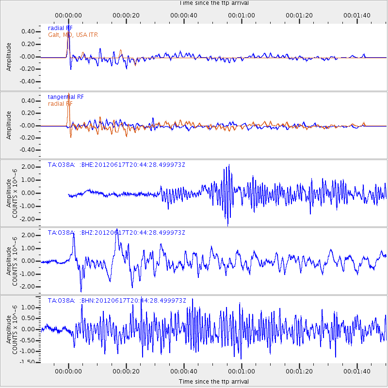
Signal To Noise
| Channel | StoN | STA | LTA |
| TA:O38A: :BHZ:20120617T20:44:28.499973Z | 16.67603 | 9.721585E-7 | 5.8296767E-8 |
| TA:O38A: :BHN:20120617T20:44:28.499973Z | 3.7155306 | 3.67073E-7 | 9.879423E-8 |
| TA:O38A: :BHE:20120617T20:44:28.499973Z | 3.0127897 | 3.5699173E-7 | 1.1849208E-7 |
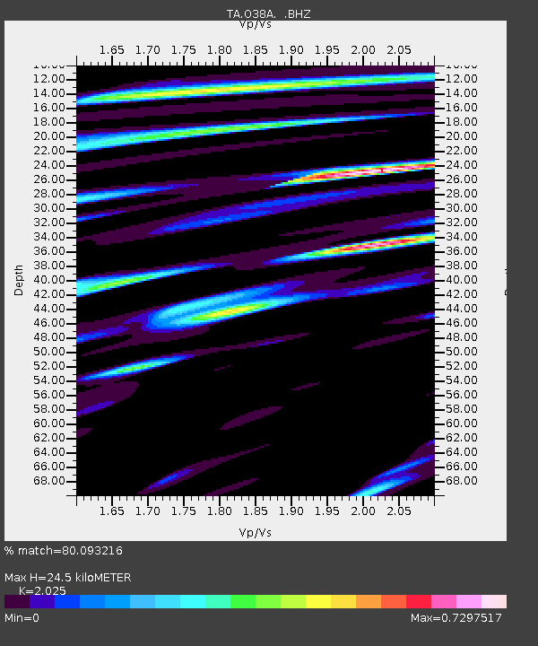
| Arrivals | |
| Ps | 3.9 SECOND |
| PpPs | 11 SECOND |
| PsPs/PpSs | 15 SECOND |

