O40A La Belle, MO, USA - Earthquake Result Viewer
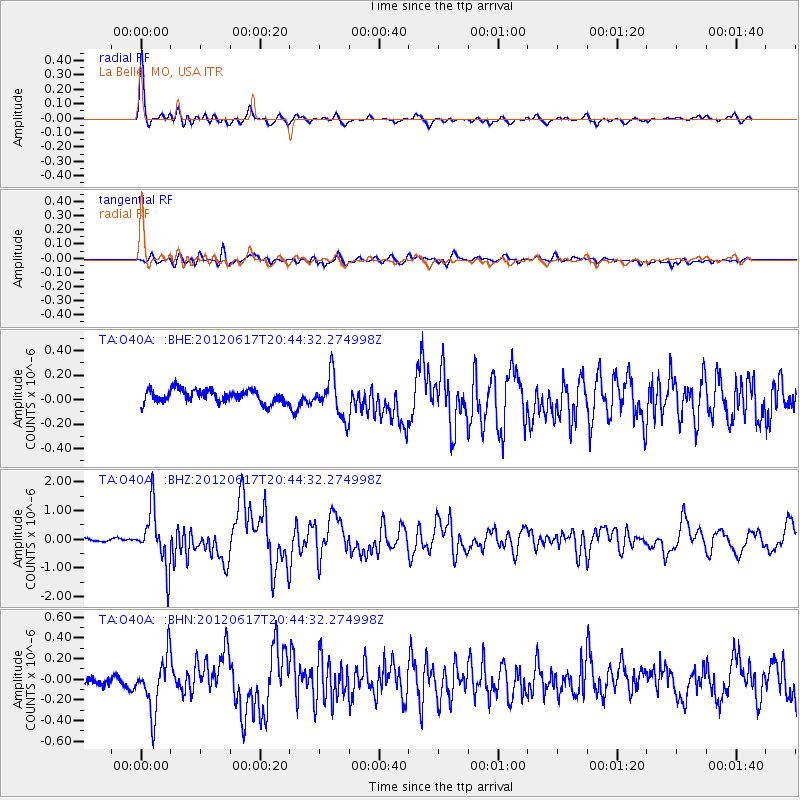
Earthquake location: Near East Coast Of Honshu, Japan
Earthquake latitude/longitude: 38.9/141.8
Earthquake time(UTC): 2012/06/17 (169) 20:32:20 GMT
Earthquake Depth: 36 km
Earthquake Magnitude: 6.0 MB, 5.9 MS, 6.3 MW, 6.4 MW
Earthquake Catalog/Contributor: WHDF/NEIC
Network: TA USArray Transportable Network (new EarthScope stations)
Station: O40A La Belle, MO, USA
Lat/Lon: 40.12 N/91.87 W
Elevation: 206 m
Distance: 87.3 deg
Az: 38.224 deg
Baz: 320.991 deg
Ray Param: 0.043389298
Estimated Moho Depth: 41.0 km
Estimated Crust Vp/Vs: 1.99
Assumed Crust Vp: 6.498 km/s
Estimated Crust Vs: 3.265 km/s
Estimated Crust Poisson's Ratio: 0.33
Radial Match: 94.05936 %
Radial Bump: 385
Transverse Match: 72.50562 %
Transverse Bump: 400
SOD ConfigId: 460165
Insert Time: 2013-02-11 21:17:53.033 +0000
GWidth: 2.5
Max Bumps: 400
Tol: 0.001

Signal To Noise

ChannelStoNSTALTA
TA:O40A: :BHZ:20120617T20:44:32.274998Z22.8835749.726194E-74.250295E-8
TA:O40A: :BHN:20120617T20:44:32.274998Z3.77918362.6385413E-76.981776E-8
TA:O40A: :BHE:20120617T20:44:32.274998Z3.098861.6427421E-75.3011178E-8
Arrivals
Ps6.4 SECOND
PpPs18 SECOND
PsPs/PpSs25 SECOND