S40A Lebanon, MO, USA - Earthquake Result Viewer
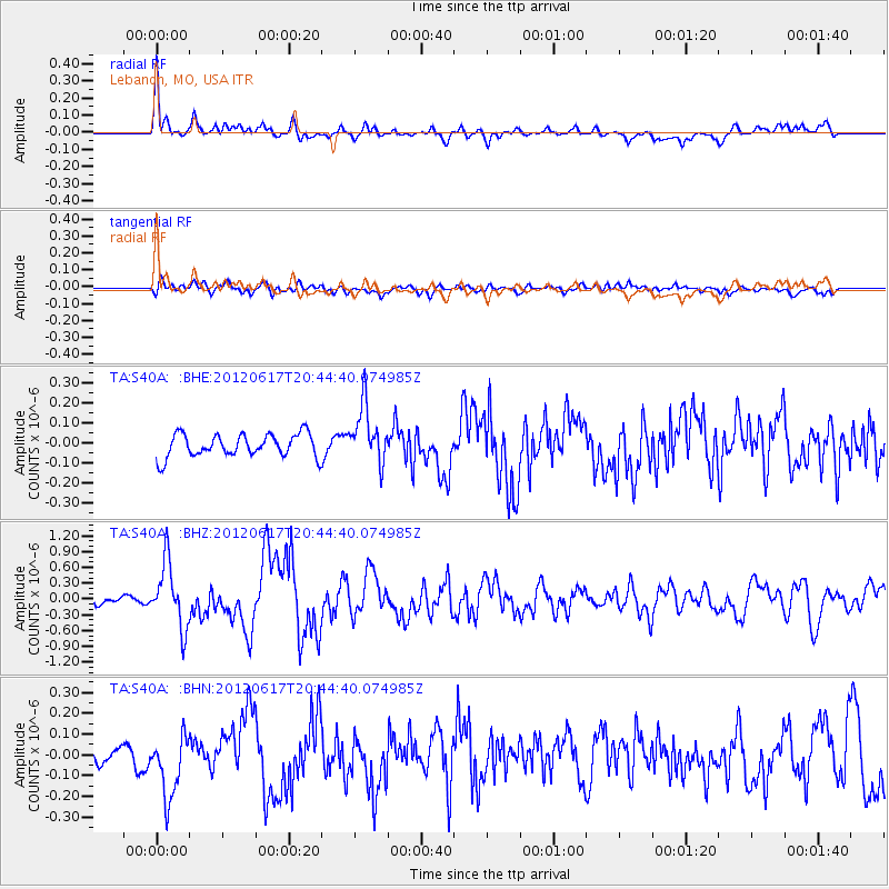
Earthquake location: Near East Coast Of Honshu, Japan
Earthquake latitude/longitude: 38.9/141.8
Earthquake time(UTC): 2012/06/17 (169) 20:32:20 GMT
Earthquake Depth: 36 km
Earthquake Magnitude: 6.0 MB, 5.9 MS, 6.3 MW, 6.4 MW
Earthquake Catalog/Contributor: WHDF/NEIC
Network: TA USArray Transportable Network (new EarthScope stations)
Station: S40A Lebanon, MO, USA
Lat/Lon: 37.60 N/92.50 W
Elevation: 336 m
Distance: 88.9 deg
Az: 40.195 deg
Baz: 320.664 deg
Ray Param: 0.04218019
Estimated Moho Depth: 50.5 km
Estimated Crust Vp/Vs: 1.72
Assumed Crust Vp: 6.53 km/s
Estimated Crust Vs: 3.802 km/s
Estimated Crust Poisson's Ratio: 0.24
Radial Match: 87.22933 %
Radial Bump: 400
Transverse Match: 64.211754 %
Transverse Bump: 400
SOD ConfigId: 460165
Insert Time: 2013-02-11 21:17:55.740 +0000
GWidth: 2.5
Max Bumps: 400
Tol: 0.001

Signal To Noise

ChannelStoNSTALTA
TA:S40A: :BHZ:20120617T20:44:40.074985Z11.1910326.0859895E-75.4382735E-8
TA:S40A: :BHN:20120617T20:44:40.074985Z3.46645931.497082E-74.318764E-8
TA:S40A: :BHE:20120617T20:44:40.074985Z2.48603631.417585E-75.7021893E-8
Arrivals
Ps5.7 SECOND
PpPs21 SECOND
PsPs/PpSs26 SECOND