
T40A Mansfield, MO, USA - Earthquake Result Viewer
| ||||||||||||||||||
| ||||||||||||||||||
| ||||||||||||||||||
|
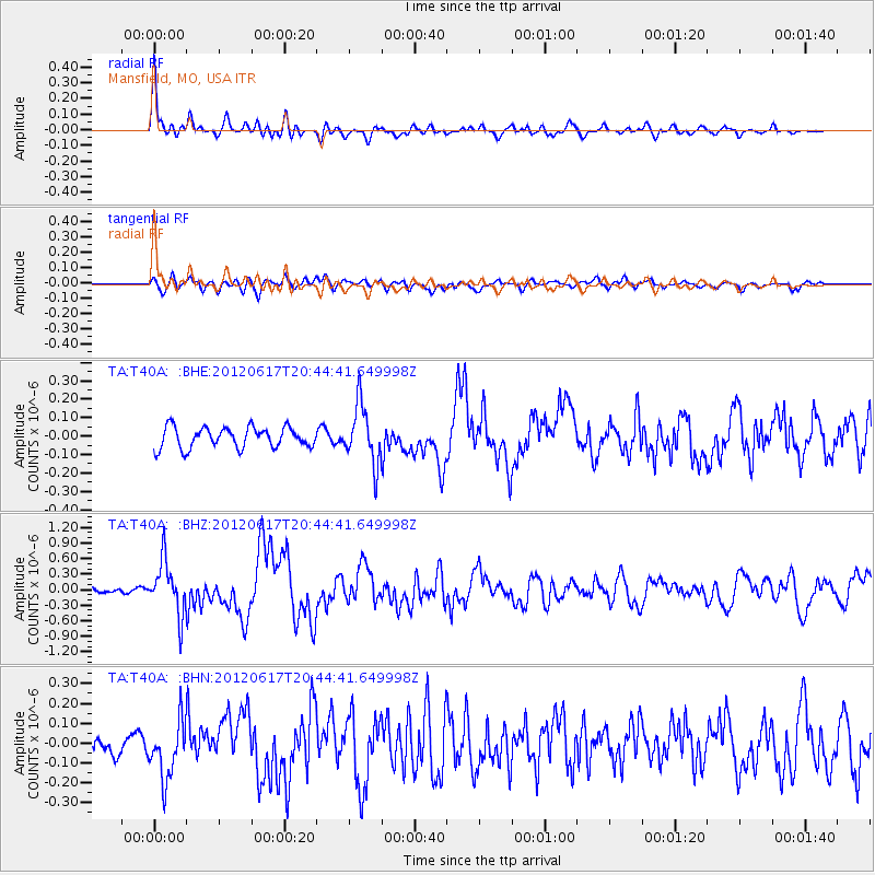
Signal To Noise
| Channel | StoN | STA | LTA |
| TA:T40A: :BHZ:20120617T20:44:41.649998Z | 6.769017 | 5.088198E-7 | 7.5168934E-8 |
| TA:T40A: :BHN:20120617T20:44:41.649998Z | 2.3264656 | 1.4652603E-7 | 6.2982245E-8 |
| TA:T40A: :BHE:20120617T20:44:41.649998Z | 2.8412247 | 1.580289E-7 | 5.5619992E-8 |
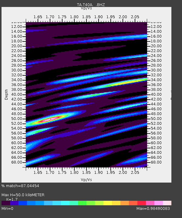
| Arrivals | |
| Ps | 5.5 SECOND |
| PpPs | 20 SECOND |
| PsPs/PpSs | 26 SECOND |

