You are here: Home > Network List > TA - USArray Transportable Network (new EarthScope stations) Stations List
> Station X43A Marvell, AR, USA > Earthquake Result Viewer
X43A Marvell, AR, USA - Earthquake Result Viewer
*The percent match for this event was below the threshold and hence no stack was calculated.
| Earthquake location: |
Near East Coast Of Honshu, Japan |
| Earthquake latitude/longitude: |
38.9/141.8 |
| Earthquake time(UTC): |
2012/06/17 (169) 20:32:20 GMT |
| Earthquake Depth: |
36 km |
| Earthquake Magnitude: |
6.0 MB, 5.9 MS, 6.3 MW, 6.4 MW |
| Earthquake Catalog/Contributor: |
WHDF/NEIC |
|
| Network: |
TA USArray Transportable Network (new EarthScope stations) |
| Station: |
X43A Marvell, AR, USA |
| Lat/Lon: |
34.52 N/90.88 W |
| Elevation: |
53 m |
|
| Distance: |
92.1 deg |
| Az: |
41.102 deg |
| Baz: |
321.605 deg |
| Ray Param: |
$rayparam |
*The percent match for this event was below the threshold and hence was not used in the summary stack. |
|
| Radial Match: |
53.113155 % |
| Radial Bump: |
400 |
| Transverse Match: |
43.08804 % |
| Transverse Bump: |
400 |
| SOD ConfigId: |
460165 |
| Insert Time: |
2013-02-11 21:23:26.189 +0000 |
| GWidth: |
2.5 |
| Max Bumps: |
400 |
| Tol: |
0.001 |
|
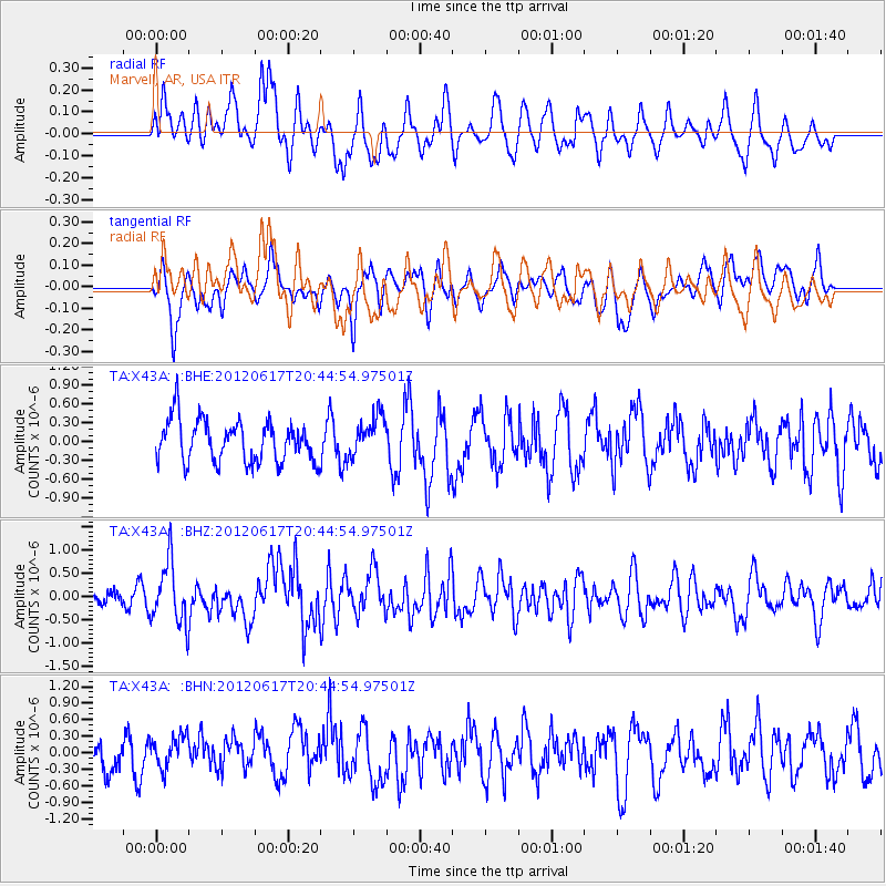
Signal To Noise
| Channel | StoN | STA | LTA |
| TA:X43A: :BHZ:20120617T20:44:54.97501Z | 3.9645643 | 6.5593696E-7 | 1.6544995E-7 |
| TA:X43A: :BHN:20120617T20:44:54.97501Z | 0.9218029 | 2.960914E-7 | 3.21209E-7 |
| TA:X43A: :BHE:20120617T20:44:54.97501Z | 0.9853447 | 3.2447596E-7 | 3.29302E-7 |
| Arrivals |
| Ps | |
| PpPs | |
| PsPs/PpSs | |


