Q43A New Douglas, IL, USA - Earthquake Result Viewer
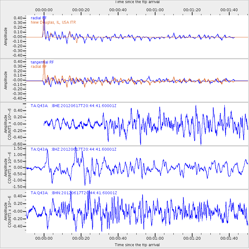
Earthquake location: Near East Coast Of Honshu, Japan
Earthquake latitude/longitude: 38.9/141.8
Earthquake time(UTC): 2012/06/17 (169) 20:32:20 GMT
Earthquake Depth: 36 km
Earthquake Magnitude: 6.0 MB, 5.9 MS, 6.3 MW, 6.4 MW
Earthquake Catalog/Contributor: WHDF/NEIC
Network: TA USArray Transportable Network (new EarthScope stations)
Station: Q43A New Douglas, IL, USA
Lat/Lon: 38.94 N/89.70 W
Elevation: 202 m
Distance: 89.2 deg
Az: 37.635 deg
Baz: 322.352 deg
Ray Param: 0.04194405
Estimated Moho Depth: 44.25 km
Estimated Crust Vp/Vs: 1.63
Assumed Crust Vp: 6.444 km/s
Estimated Crust Vs: 3.941 km/s
Estimated Crust Poisson's Ratio: 0.20
Radial Match: 83.14314 %
Radial Bump: 400
Transverse Match: 73.854225 %
Transverse Bump: 400
SOD ConfigId: 460165
Insert Time: 2013-02-11 21:23:46.735 +0000
GWidth: 2.5
Max Bumps: 400
Tol: 0.001

Signal To Noise

ChannelStoNSTALTA
TA:Q43A: :BHZ:20120617T20:44:41.60001Z9.3096.3020013E-76.769794E-8
TA:Q43A: :BHN:20120617T20:44:41.60001Z2.36721041.8516985E-77.822282E-8
TA:Q43A: :BHE:20120617T20:44:41.60001Z1.98772621.7036464E-78.57083E-8
Arrivals
Ps4.5 SECOND
PpPs18 SECOND
PsPs/PpSs22 SECOND