
K39A Oelwein, IA, USA - Earthquake Result Viewer
| ||||||||||||||||||
| ||||||||||||||||||
| ||||||||||||||||||
|
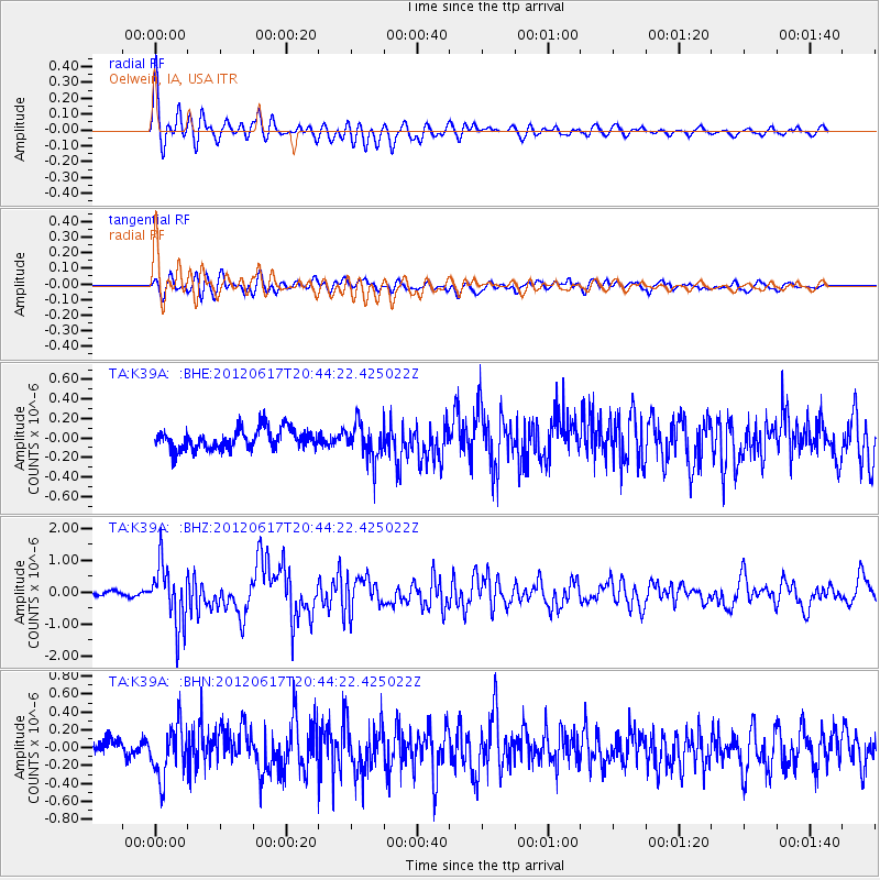
Signal To Noise
| Channel | StoN | STA | LTA |
| TA:K39A: :BHZ:20120617T20:44:22.425022Z | 12.818764 | 9.434066E-7 | 7.359575E-8 |
| TA:K39A: :BHN:20120617T20:44:22.425022Z | 3.435209 | 2.875424E-7 | 8.3704485E-8 |
| TA:K39A: :BHE:20120617T20:44:22.425022Z | 1.7798162 | 1.8388918E-7 | 1.033192E-7 |
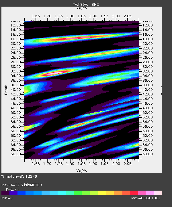
| Arrivals | |
| Ps | 3.8 SECOND |
| PpPs | 13 SECOND |
| PsPs/PpSs | 17 SECOND |

