M39A Webster, IA, USA - Earthquake Result Viewer
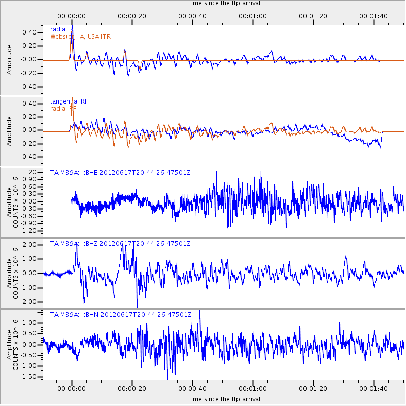
Earthquake location: Near East Coast Of Honshu, Japan
Earthquake latitude/longitude: 38.9/141.8
Earthquake time(UTC): 2012/06/17 (169) 20:32:20 GMT
Earthquake Depth: 36 km
Earthquake Magnitude: 6.0 MB, 5.9 MS, 6.3 MW, 6.4 MW
Earthquake Catalog/Contributor: WHDF/NEIC
Network: TA USArray Transportable Network (new EarthScope stations)
Station: M39A Webster, IA, USA
Lat/Lon: 41.48 N/92.17 W
Elevation: 264 m
Distance: 86.1 deg
Az: 37.543 deg
Baz: 320.757 deg
Ray Param: 0.044256106
Estimated Moho Depth: 42.5 km
Estimated Crust Vp/Vs: 1.78
Assumed Crust Vp: 6.498 km/s
Estimated Crust Vs: 3.65 km/s
Estimated Crust Poisson's Ratio: 0.27
Radial Match: 80.26581 %
Radial Bump: 400
Transverse Match: 51.6985 %
Transverse Bump: 400
SOD ConfigId: 460165
Insert Time: 2013-02-11 21:24:47.417 +0000
GWidth: 2.5
Max Bumps: 400
Tol: 0.001

Signal To Noise

ChannelStoNSTALTA
TA:M39A: :BHZ:20120617T20:44:26.47501Z10.3946868.876918E-78.539862E-8
TA:M39A: :BHN:20120617T20:44:26.47501Z1.00593452.665764E-72.6500376E-7
TA:M39A: :BHE:20120617T20:44:26.47501Z1.32578652.82459E-72.1305017E-7
Arrivals
Ps5.2 SECOND
PpPs18 SECOND
PsPs/PpSs23 SECOND