
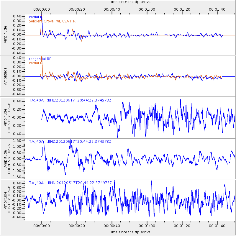
J40A Soldiers Grove, WI, USA - Earthquake Result Viewer
| ||||||||||||||||||
| ||||||||||||||||||
| ||||||||||||||||||
|
Signal To Noise
| Channel | StoN | STA | LTA |
| TA:J40A: :BHZ:20120617T20:44:22.374973Z | 15.304041 | 6.8673717E-7 | 4.4872927E-8 |
| TA:J40A: :BHN:20120617T20:44:22.374973Z | 1.6718084 | 1.5271948E-7 | 9.1349875E-8 |
| TA:J40A: :BHE:20120617T20:44:22.374973Z | 2.9362283 | 1.7348971E-7 | 5.9085902E-8 |
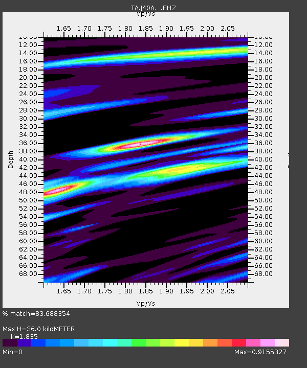
| Arrivals | |
| Ps | 4.7 SECOND |
| PpPs | 15 SECOND |
| PsPs/PpSs | 20 SECOND |

