U41A Viola, AR, USA - Earthquake Result Viewer
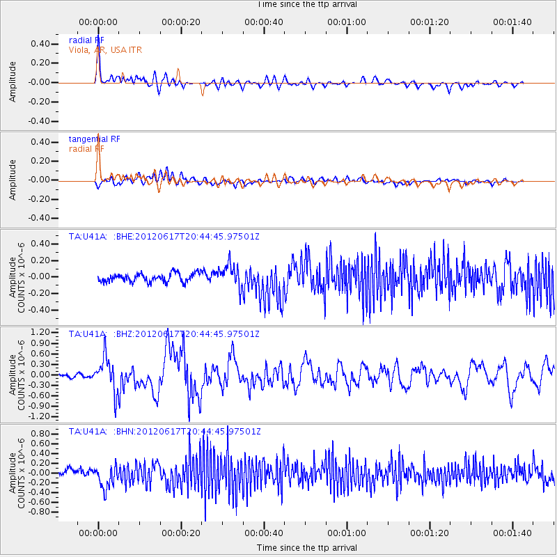
Earthquake location: Near East Coast Of Honshu, Japan
Earthquake latitude/longitude: 38.9/141.8
Earthquake time(UTC): 2012/06/17 (169) 20:32:20 GMT
Earthquake Depth: 36 km
Earthquake Magnitude: 6.0 MB, 5.9 MS, 6.3 MW, 6.4 MW
Earthquake Catalog/Contributor: WHDF/NEIC
Network: TA USArray Transportable Network (new EarthScope stations)
Station: U41A Viola, AR, USA
Lat/Lon: 36.34 N/91.92 W
Elevation: 300 m
Distance: 90.2 deg
Az: 40.625 deg
Baz: 321.015 deg
Ray Param: 0.041686825
Estimated Moho Depth: 40.0 km
Estimated Crust Vp/Vs: 1.72
Assumed Crust Vp: 6.53 km/s
Estimated Crust Vs: 3.802 km/s
Estimated Crust Poisson's Ratio: 0.24
Radial Match: 84.11759 %
Radial Bump: 400
Transverse Match: 55.443413 %
Transverse Bump: 400
SOD ConfigId: 460165
Insert Time: 2013-02-11 21:25:27.063 +0000
GWidth: 2.5
Max Bumps: 400
Tol: 0.001

Signal To Noise

ChannelStoNSTALTA
TA:U41A: :BHZ:20120617T20:44:45.97501Z11.7007665.1247764E-74.379864E-8
TA:U41A: :BHN:20120617T20:44:45.97501Z3.83501722.447021E-76.3807306E-8
TA:U41A: :BHE:20120617T20:44:45.97501Z2.77536441.410848E-75.0834693E-8
Arrivals
Ps4.5 SECOND
PpPs16 SECOND
PsPs/PpSs21 SECOND