
S42A Caledonia, MO, USA - Earthquake Result Viewer
| ||||||||||||||||||
| ||||||||||||||||||
| ||||||||||||||||||
|
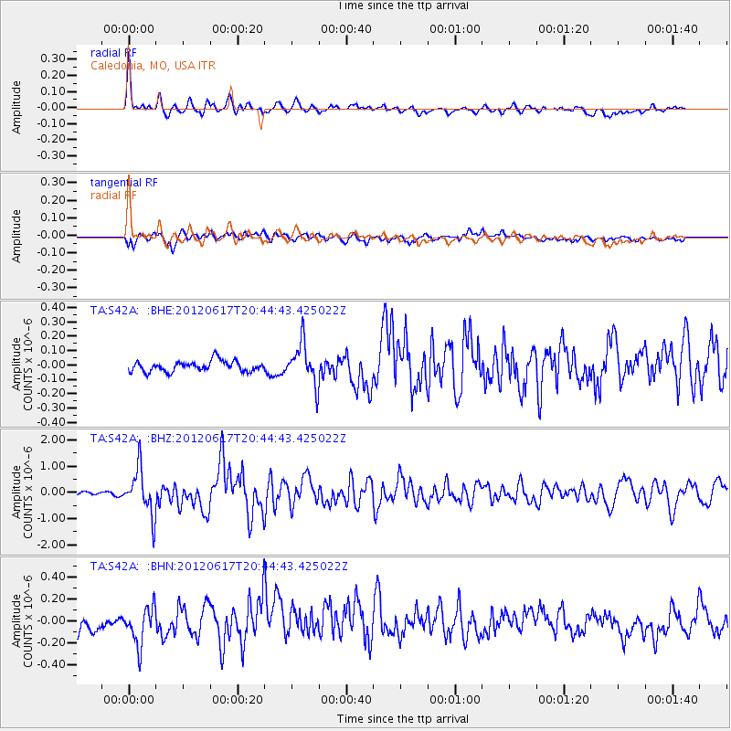
Signal To Noise
| Channel | StoN | STA | LTA |
| TA:S42A: :BHZ:20120617T20:44:43.425022Z | 13.352232 | 8.809368E-7 | 6.597674E-8 |
| TA:S42A: :BHN:20120617T20:44:43.425022Z | 2.0640092 | 1.701911E-7 | 8.245656E-8 |
| TA:S42A: :BHE:20120617T20:44:43.425022Z | 3.901646 | 1.4324046E-7 | 3.671283E-8 |
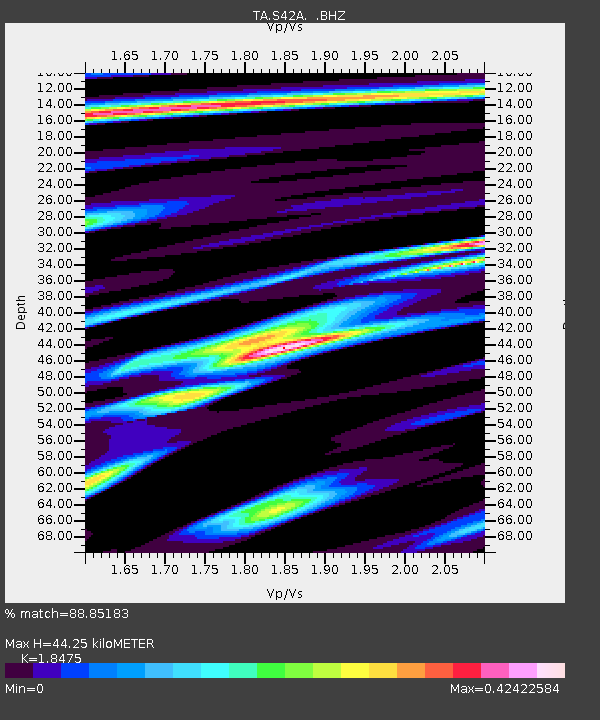
| Arrivals | |
| Ps | 5.9 SECOND |
| PpPs | 19 SECOND |
| PsPs/PpSs | 25 SECOND |

