R41A Rosebud, MO, USA - Earthquake Result Viewer
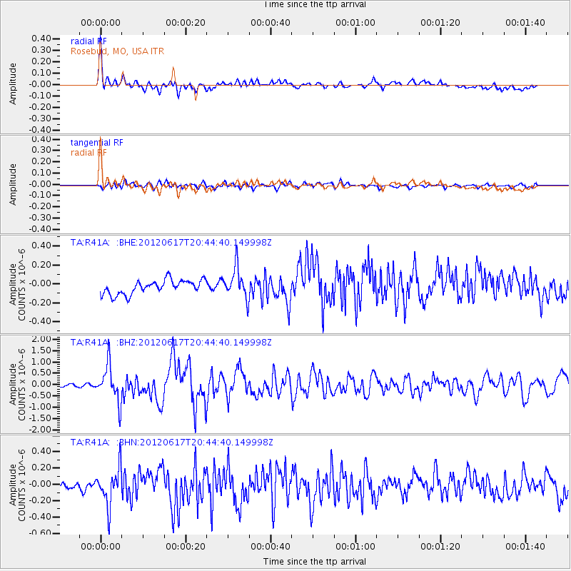
Earthquake location: Near East Coast Of Honshu, Japan
Earthquake latitude/longitude: 38.9/141.8
Earthquake time(UTC): 2012/06/17 (169) 20:32:20 GMT
Earthquake Depth: 36 km
Earthquake Magnitude: 6.0 MB, 5.9 MS, 6.3 MW, 6.4 MW
Earthquake Catalog/Contributor: WHDF/NEIC
Network: TA USArray Transportable Network (new EarthScope stations)
Station: R41A Rosebud, MO, USA
Lat/Lon: 38.30 N/91.38 W
Elevation: 257 m
Distance: 88.9 deg
Az: 39.067 deg
Baz: 321.33 deg
Ray Param: 0.042168483
Estimated Moho Depth: 40.75 km
Estimated Crust Vp/Vs: 1.84
Assumed Crust Vp: 6.498 km/s
Estimated Crust Vs: 3.541 km/s
Estimated Crust Poisson's Ratio: 0.29
Radial Match: 83.40741 %
Radial Bump: 400
Transverse Match: 69.08789 %
Transverse Bump: 400
SOD ConfigId: 460165
Insert Time: 2013-02-11 21:25:52.093 +0000
GWidth: 2.5
Max Bumps: 400
Tol: 0.001

Signal To Noise

ChannelStoNSTALTA
TA:R41A: :BHZ:20120617T20:44:40.149998Z13.8312418.3282407E-76.021326E-8
TA:R41A: :BHN:20120617T20:44:40.149998Z2.78959852.4403926E-78.748186E-8
TA:R41A: :BHE:20120617T20:44:40.149998Z2.24545071.661722E-77.4003935E-8
Arrivals
Ps5.3 SECOND
PpPs17 SECOND
PsPs/PpSs23 SECOND