M41A Milan, IL, USA - Earthquake Result Viewer
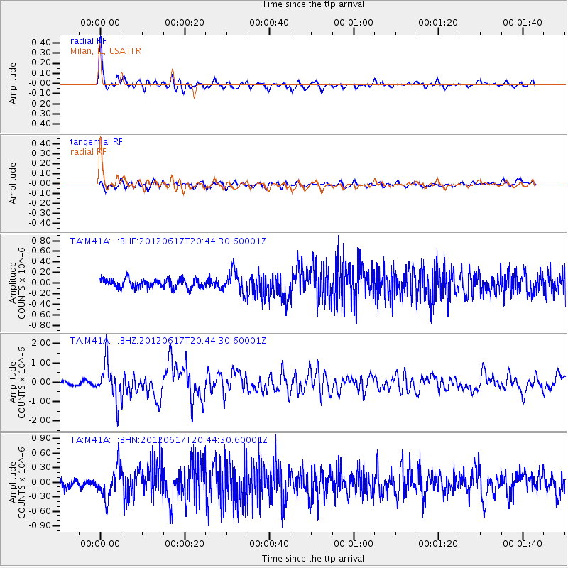
Earthquake location: Near East Coast Of Honshu, Japan
Earthquake latitude/longitude: 38.9/141.8
Earthquake time(UTC): 2012/06/17 (169) 20:32:20 GMT
Earthquake Depth: 36 km
Earthquake Magnitude: 6.0 MB, 5.9 MS, 6.3 MW, 6.4 MW
Earthquake Catalog/Contributor: WHDF/NEIC
Network: TA USArray Transportable Network (new EarthScope stations)
Station: M41A Milan, IL, USA
Lat/Lon: 41.38 N/90.54 W
Elevation: 226 m
Distance: 86.9 deg
Az: 36.649 deg
Baz: 321.777 deg
Ray Param: 0.043643374
Estimated Moho Depth: 39.0 km
Estimated Crust Vp/Vs: 1.89
Assumed Crust Vp: 6.498 km/s
Estimated Crust Vs: 3.429 km/s
Estimated Crust Poisson's Ratio: 0.31
Radial Match: 90.99796 %
Radial Bump: 400
Transverse Match: 74.84245 %
Transverse Bump: 400
SOD ConfigId: 460165
Insert Time: 2013-02-11 21:26:26.170 +0000
GWidth: 2.5
Max Bumps: 400
Tol: 0.001

Signal To Noise

ChannelStoNSTALTA
TA:M41A: :BHZ:20120617T20:44:30.60001Z11.7958759.517168E-78.068218E-8
TA:M41A: :BHN:20120617T20:44:30.60001Z3.86393713.1228194E-78.081962E-8
TA:M41A: :BHE:20120617T20:44:30.60001Z2.44227051.9757654E-78.089871E-8
Arrivals
Ps5.5 SECOND
PpPs17 SECOND
PsPs/PpSs22 SECOND