
H41A Junction City, WI, USA - Earthquake Result Viewer
| ||||||||||||||||||
| ||||||||||||||||||
| ||||||||||||||||||
|
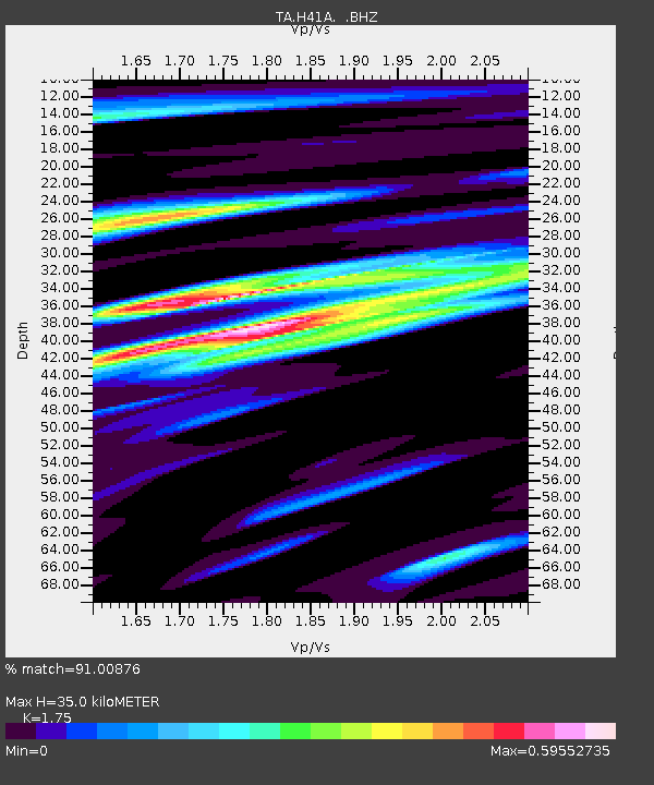
Signal To Noise
| Channel | StoN | STA | LTA |
| TA:H41A: :BHZ:20120617T20:44:19.999973Z | 10.845877 | 7.0681614E-7 | 6.516912E-8 |
| TA:H41A: :BHN:20120617T20:44:19.999973Z | 4.14862 | 1.7684854E-7 | 4.2628283E-8 |
| TA:H41A: :BHE:20120617T20:44:19.999973Z | 1.5248128 | 1.027375E-7 | 6.737712E-8 |
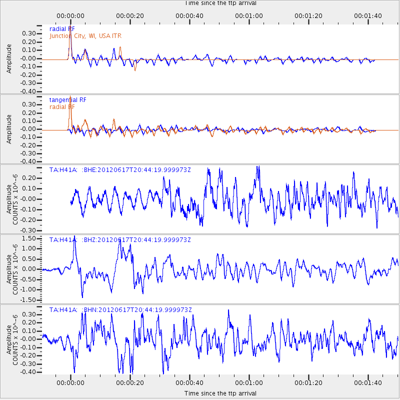
| Arrivals | |
| Ps | 4.2 SECOND |
| PpPs | 15 SECOND |
| PsPs/PpSs | 19 SECOND |

