G40A Rib Lake, WI, USA - Earthquake Result Viewer
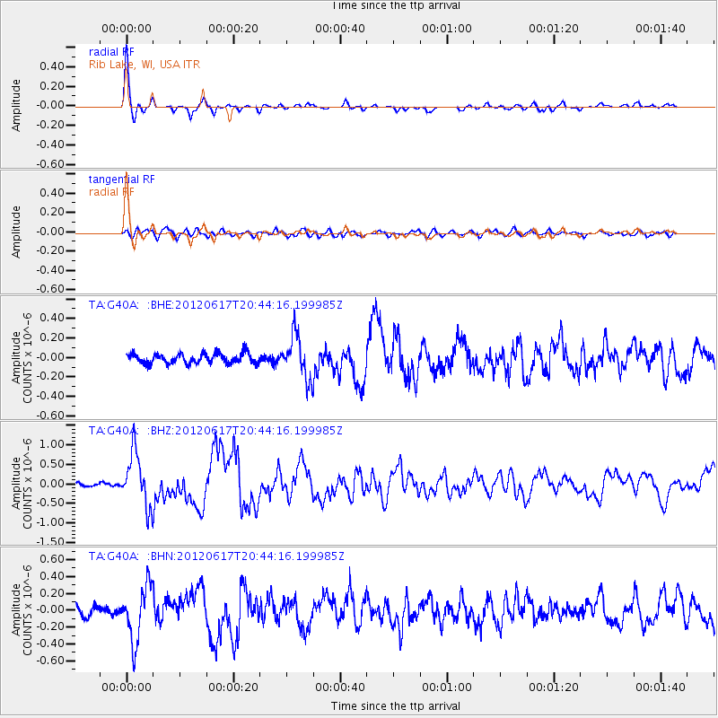
Earthquake location: Near East Coast Of Honshu, Japan
Earthquake latitude/longitude: 38.9/141.8
Earthquake time(UTC): 2012/06/17 (169) 20:32:20 GMT
Earthquake Depth: 36 km
Earthquake Magnitude: 6.0 MB, 5.9 MS, 6.3 MW, 6.4 MW
Earthquake Catalog/Contributor: WHDF/NEIC
Network: TA USArray Transportable Network (new EarthScope stations)
Station: G40A Rib Lake, WI, USA
Lat/Lon: 45.27 N/90.20 W
Elevation: 472 m
Distance: 84.0 deg
Az: 34.038 deg
Baz: 321.805 deg
Ray Param: 0.04572176
Estimated Moho Depth: 52.0 km
Estimated Crust Vp/Vs: 1.61
Assumed Crust Vp: 6.571 km/s
Estimated Crust Vs: 4.075 km/s
Estimated Crust Poisson's Ratio: 0.19
Radial Match: 95.188896 %
Radial Bump: 302
Transverse Match: 70.48083 %
Transverse Bump: 400
SOD ConfigId: 460165
Insert Time: 2013-02-11 21:28:05.999 +0000
GWidth: 2.5
Max Bumps: 400
Tol: 0.001

Signal To Noise

ChannelStoNSTALTA
TA:G40A: :BHZ:20120617T20:44:16.199985Z10.9848416.919467E-76.299105E-8
TA:G40A: :BHN:20120617T20:44:16.199985Z4.59741453.2654296E-77.102752E-8
TA:G40A: :BHE:20120617T20:44:16.199985Z4.2864152.2023475E-75.1379708E-8
Arrivals
Ps5.0 SECOND
PpPs20 SECOND
PsPs/PpSs25 SECOND