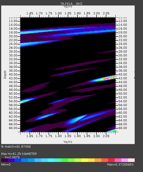
F41A Wisconsin Rapids, WI, USA - Earthquake Result Viewer
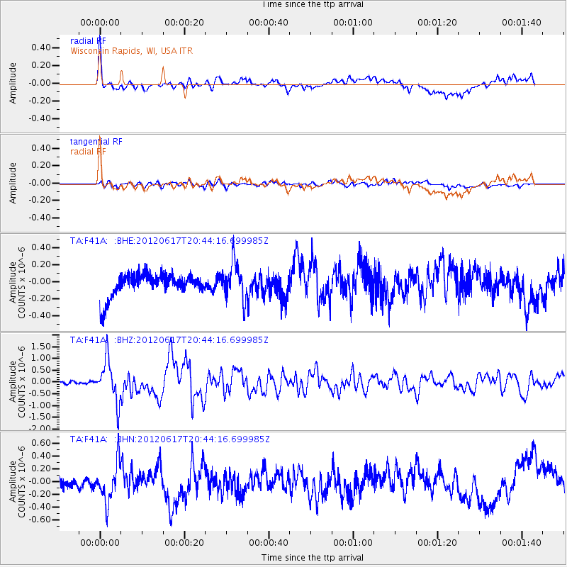
Earthquake location: Near East Coast Of Honshu, Japan
Earthquake latitude/longitude: 38.9/141.8
Earthquake time(UTC): 2012/06/17 (169) 20:32:20 GMT
Earthquake Depth: 36 km
Earthquake Magnitude: 6.0 MB, 5.9 MS, 6.3 MW, 6.4 MW
Earthquake Catalog/Contributor: WHDF/NEIC
Network: TA USArray Transportable Network (new EarthScope stations)
Station: F41A Wisconsin Rapids, WI, USA
Lat/Lon: 45.74 N/89.10 W
Elevation: 509 m
Distance: 84.1 deg
Az: 33.136 deg
Baz: 322.491 deg
Ray Param: 0.045652367
Estimated Moho Depth: 41.25 km
Estimated Crust Vp/Vs: 2.09
Assumed Crust Vp: 6.41 km/s
Estimated Crust Vs: 3.071 km/s
Estimated Crust Poisson's Ratio: 0.35
Radial Match: 81.97458 %
Radial Bump: 400
Transverse Match: 61.084644 %
Transverse Bump: 400
SOD ConfigId: 460165
Insert Time: 2013-02-11 21:28:53.435 +0000
GWidth: 2.5
Max Bumps: 400
Tol: 0.001

Signal To Noise

ChannelStoNSTALTA
TA:F41A: :BHZ:20120617T20:44:16.699985Z15.5350939.0791804E-75.8443035E-8
TA:F41A: :BHN:20120617T20:44:16.699985Z1.74006353.2279056E-71.8550504E-7
TA:F41A: :BHE:20120617T20:44:16.699985Z1.64076972.2082928E-71.3458883E-7
Arrivals
Ps7.1 SECOND
PpPs19 SECOND
PsPs/PpSs27 SECOND