F39A Loretta, WI, USA - Earthquake Result Viewer
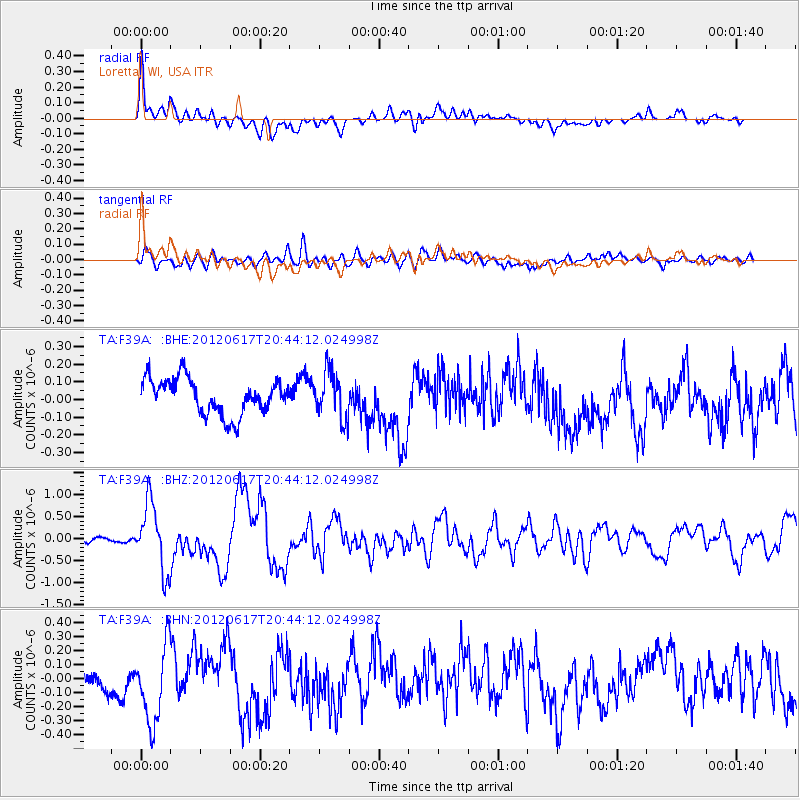
Earthquake location: Near East Coast Of Honshu, Japan
Earthquake latitude/longitude: 38.9/141.8
Earthquake time(UTC): 2012/06/17 (169) 20:32:20 GMT
Earthquake Depth: 36 km
Earthquake Magnitude: 6.0 MB, 5.9 MS, 6.3 MW, 6.4 MW
Earthquake Catalog/Contributor: WHDF/NEIC
Network: TA USArray Transportable Network (new EarthScope stations)
Station: F39A Loretta, WI, USA
Lat/Lon: 45.92 N/90.92 W
Elevation: 440 m
Distance: 83.2 deg
Az: 34.031 deg
Baz: 321.292 deg
Ray Param: 0.04630314
Estimated Moho Depth: 54.25 km
Estimated Crust Vp/Vs: 1.61
Assumed Crust Vp: 6.571 km/s
Estimated Crust Vs: 4.094 km/s
Estimated Crust Poisson's Ratio: 0.18
Radial Match: 84.91086 %
Radial Bump: 400
Transverse Match: 69.34872 %
Transverse Bump: 400
SOD ConfigId: 460165
Insert Time: 2013-02-11 21:29:05.549 +0000
GWidth: 2.5
Max Bumps: 400
Tol: 0.001

Signal To Noise

ChannelStoNSTALTA
TA:F39A: :BHZ:20120617T20:44:12.024998Z11.2348217.606273E-76.770266E-8
TA:F39A: :BHN:20120617T20:44:12.024998Z3.00784952.8123623E-79.3500766E-8
TA:F39A: :BHE:20120617T20:44:12.024998Z1.31985721.3281398E-71.0062753E-7
Arrivals
Ps5.1 SECOND
PpPs21 SECOND
PsPs/PpSs26 SECOND