
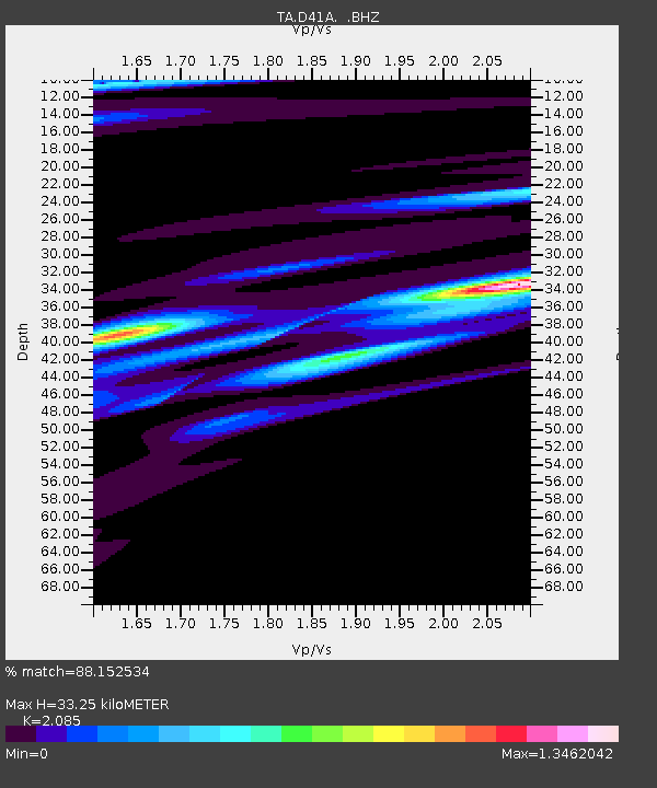
D41A Chassel, MI, USA - Earthquake Result Viewer
| ||||||||||||||||||
| ||||||||||||||||||
| ||||||||||||||||||
|
Signal To Noise
| Channel | StoN | STA | LTA |
| TA:D41A: :BHZ:20120617T20:44:12.524998Z | 6.591627 | 1.057412E-6 | 1.6041743E-7 |
| TA:D41A: :BHN:20120617T20:44:12.524998Z | 3.8432493 | 5.4900295E-7 | 1.4284863E-7 |
| TA:D41A: :BHE:20120617T20:44:12.524998Z | 2.8936589 | 4.180406E-7 | 1.4446782E-7 |
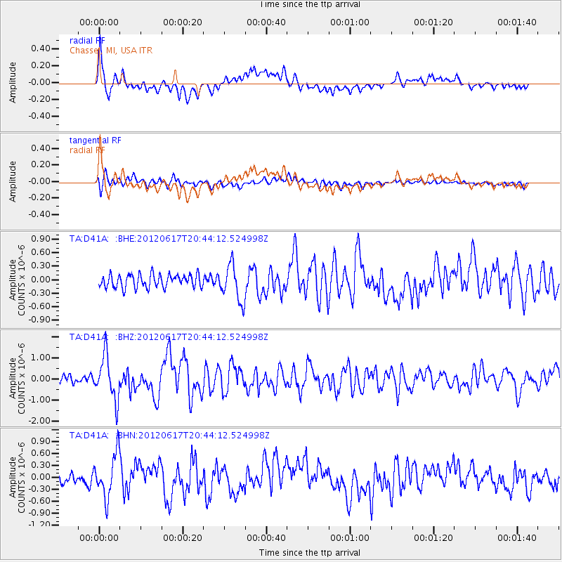
| Arrivals | |
| Ps | 5.7 SECOND |
| PpPs | 16 SECOND |
| PsPs/PpSs | 21 SECOND |

