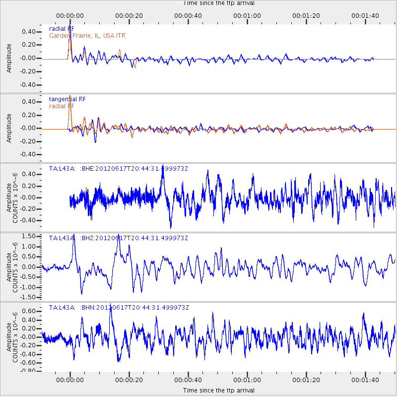
L43A Garden Prairie, IL, USA - Earthquake Result Viewer
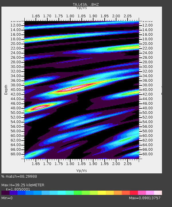
Earthquake location: Near East Coast Of Honshu, Japan
Earthquake latitude/longitude: 38.9/141.8
Earthquake time(UTC): 2012/06/17 (169) 20:32:20 GMT
Earthquake Depth: 36 km
Earthquake Magnitude: 6.0 MB, 5.9 MS, 6.3 MW, 6.4 MW
Earthquake Catalog/Contributor: WHDF/NEIC
Network: TA USArray Transportable Network (new EarthScope stations)
Station: L43A Garden Prairie, IL, USA
Lat/Lon: 42.18 N/88.74 W
Elevation: 266 m
Distance: 87.1 deg
Az: 35.088 deg
Baz: 322.891 deg
Ray Param: 0.043509163
Estimated Moho Depth: 39.25 km
Estimated Crust Vp/Vs: 1.81
Assumed Crust Vp: 6.571 km/s
Estimated Crust Vs: 3.64 km/s
Estimated Crust Poisson's Ratio: 0.28
Radial Match: 88.29988 %
Radial Bump: 400
Transverse Match: 73.72128 %
Transverse Bump: 400
SOD ConfigId: 460165
Insert Time: 2013-02-11 21:29:40.729 +0000
GWidth: 2.5
Max Bumps: 400
Tol: 0.001

Signal To Noise

ChannelStoNSTALTA
TA:L43A: :BHZ:20120617T20:44:31.499973Z11.0272047.2603643E-76.584048E-8
TA:L43A: :BHN:20120617T20:44:31.499973Z2.48500042.1732166E-78.745337E-8
TA:L43A: :BHE:20120617T20:44:31.499973Z2.4738462.4265472E-79.8088044E-8
Arrivals
Ps4.9 SECOND
PpPs16 SECOND
PsPs/PpSs21 SECOND