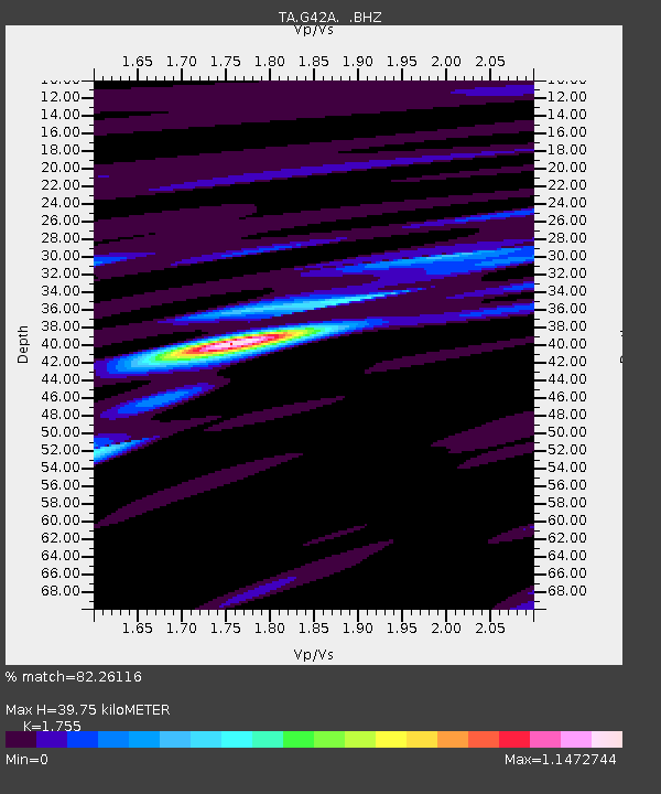
G42A Mountain, WI, USA - Earthquake Result Viewer
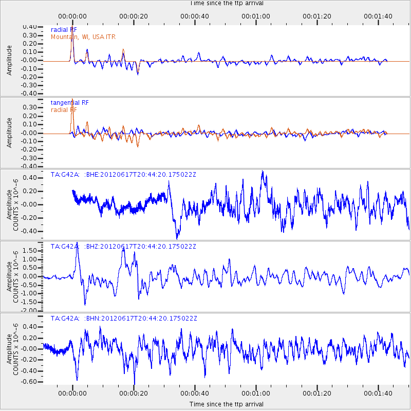
Earthquake location: Near East Coast Of Honshu, Japan
Earthquake latitude/longitude: 38.9/141.8
Earthquake time(UTC): 2012/06/17 (169) 20:32:20 GMT
Earthquake Depth: 36 km
Earthquake Magnitude: 6.0 MB, 5.9 MS, 6.3 MW, 6.4 MW
Earthquake Catalog/Contributor: WHDF/NEIC
Network: TA USArray Transportable Network (new EarthScope stations)
Station: G42A Mountain, WI, USA
Lat/Lon: 45.24 N/88.43 W
Elevation: 315 m
Distance: 84.8 deg
Az: 33.058 deg
Baz: 322.964 deg
Ray Param: 0.04516478
Estimated Moho Depth: 39.75 km
Estimated Crust Vp/Vs: 1.75
Assumed Crust Vp: 6.41 km/s
Estimated Crust Vs: 3.653 km/s
Estimated Crust Poisson's Ratio: 0.26
Radial Match: 82.26116 %
Radial Bump: 400
Transverse Match: 67.40514 %
Transverse Bump: 400
SOD ConfigId: 460165
Insert Time: 2013-02-11 21:30:17.992 +0000
GWidth: 2.5
Max Bumps: 400
Tol: 0.001

Signal To Noise

ChannelStoNSTALTA
TA:G42A: :BHZ:20120617T20:44:20.175022Z11.3932818.853119E-77.770474E-8
TA:G42A: :BHN:20120617T20:44:20.175022Z2.69807122.3498335E-78.7093085E-8
TA:G42A: :BHE:20120617T20:44:20.175022Z3.0149362.4582442E-78.153553E-8
Arrivals
Ps4.8 SECOND
PpPs17 SECOND
PsPs/PpSs21 SECOND