
N45A Kentland, IN, USA - Earthquake Result Viewer
| ||||||||||||||||||
| ||||||||||||||||||
| ||||||||||||||||||
|
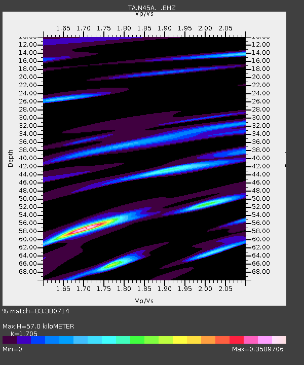
Signal To Noise
| Channel | StoN | STA | LTA |
| TA:N45A: :BHZ:20120617T20:44:39.199985Z | 11.836626 | 8.5016836E-7 | 7.182523E-8 |
| TA:N45A: :BHN:20120617T20:44:39.199985Z | 1.7506545 | 1.9303017E-7 | 1.1026172E-7 |
| TA:N45A: :BHE:20120617T20:44:39.199985Z | 2.8061788 | 1.993376E-7 | 7.103525E-8 |
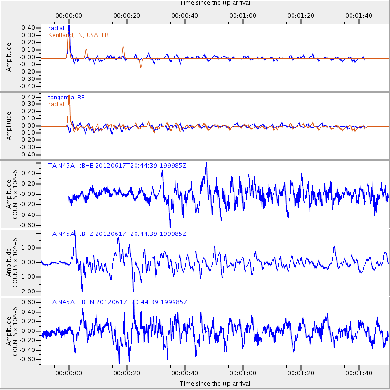
| Arrivals | |
| Ps | 6.3 SECOND |
| PpPs | 23 SECOND |
| PsPs/PpSs | 30 SECOND |

