You are here: Home > Network List > TA - USArray Transportable Network (new EarthScope stations) Stations List
> Station Z50A Ashland, AL, USA > Earthquake Result Viewer
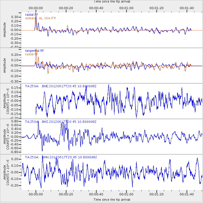
Z50A Ashland, AL, USA - Earthquake Result Viewer
*The percent match for this event was below the threshold and hence no stack was calculated.
| Earthquake location: |
Near East Coast Of Honshu, Japan |
| Earthquake latitude/longitude: |
38.9/141.8 |
| Earthquake time(UTC): |
2012/06/17 (169) 20:32:20 GMT |
| Earthquake Depth: |
36 km |
| Earthquake Magnitude: |
6.0 MB, 5.9 MS, 6.3 MW, 6.4 MW |
| Earthquake Catalog/Contributor: |
WHDF/NEIC |
|
| Network: |
TA USArray Transportable Network (new EarthScope stations) |
| Station: |
Z50A Ashland, AL, USA |
| Lat/Lon: |
33.25 N/85.92 W |
| Elevation: |
370 m |
|
| Distance: |
95.6 deg |
| Az: |
38.557 deg |
| Baz: |
324.531 deg |
| Ray Param: |
$rayparam |
*The percent match for this event was below the threshold and hence was not used in the summary stack. |
|
| Radial Match: |
67.05355 % |
| Radial Bump: |
400 |
| Transverse Match: |
43.581932 % |
| Transverse Bump: |
400 |
| SOD ConfigId: |
460165 |
| Insert Time: |
2013-02-11 21:34:32.167 +0000 |
| GWidth: |
2.5 |
| Max Bumps: |
400 |
| Tol: |
0.001 |
|
Signal To Noise
| Channel | StoN | STA | LTA |
| TA:Z50A: :BHZ:20120617T20:45:10.899998Z | 4.4400263 | 3.2638428E-7 | 7.350954E-8 |
| TA:Z50A: :BHN:20120617T20:45:10.899998Z | 2.2547498 | 1.2393502E-7 | 5.4966197E-8 |
| TA:Z50A: :BHE:20120617T20:45:10.899998Z | 1.3568618 | 9.0520786E-8 | 6.671334E-8 |
| Arrivals |
| Ps | |
| PpPs | |
| PsPs/PpSs | |


