You are here: Home > Network List > TA - USArray Transportable Network (new EarthScope stations) Stations List
> Station U53A Fall Branch, TN, USA > Earthquake Result Viewer
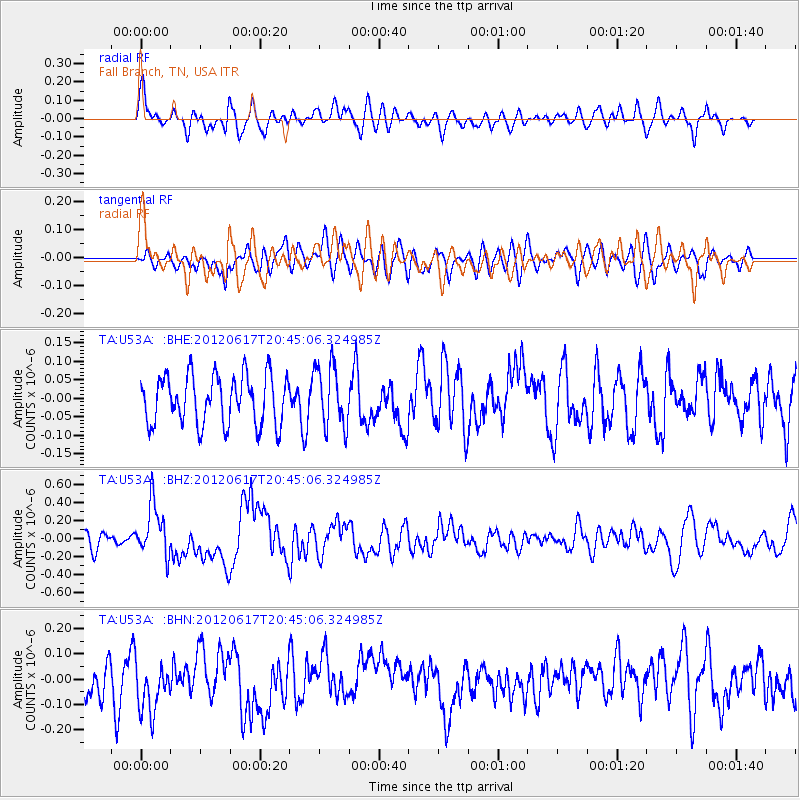
U53A Fall Branch, TN, USA - Earthquake Result Viewer
*The percent match for this event was below the threshold and hence no stack was calculated.
| Earthquake location: |
Near East Coast Of Honshu, Japan |
| Earthquake latitude/longitude: |
38.9/141.8 |
| Earthquake time(UTC): |
2012/06/17 (169) 20:32:20 GMT |
| Earthquake Depth: |
36 km |
| Earthquake Magnitude: |
6.0 MB, 5.9 MS, 6.3 MW, 6.4 MW |
| Earthquake Catalog/Contributor: |
WHDF/NEIC |
|
| Network: |
TA USArray Transportable Network (new EarthScope stations) |
| Station: |
U53A Fall Branch, TN, USA |
| Lat/Lon: |
36.36 N/82.58 W |
| Elevation: |
559 m |
|
| Distance: |
94.6 deg |
| Az: |
34.517 deg |
| Baz: |
326.794 deg |
| Ray Param: |
$rayparam |
*The percent match for this event was below the threshold and hence was not used in the summary stack. |
|
| Radial Match: |
72.562904 % |
| Radial Bump: |
400 |
| Transverse Match: |
49.719383 % |
| Transverse Bump: |
400 |
| SOD ConfigId: |
460165 |
| Insert Time: |
2013-02-11 21:37:52.930 +0000 |
| GWidth: |
2.5 |
| Max Bumps: |
400 |
| Tol: |
0.001 |
|
Signal To Noise
| Channel | StoN | STA | LTA |
| TA:U53A: :BHZ:20120617T20:45:06.324985Z | 3.0045106 | 2.9010585E-7 | 9.6556775E-8 |
| TA:U53A: :BHN:20120617T20:45:06.324985Z | 1.4682685 | 1.0517211E-7 | 7.1630026E-8 |
| TA:U53A: :BHE:20120617T20:45:06.324985Z | 1.2415253 | 8.1948485E-8 | 6.6006294E-8 |
| Arrivals |
| Ps | |
| PpPs | |
| PsPs/PpSs | |


