T50A Nancy, KY, USA - Earthquake Result Viewer
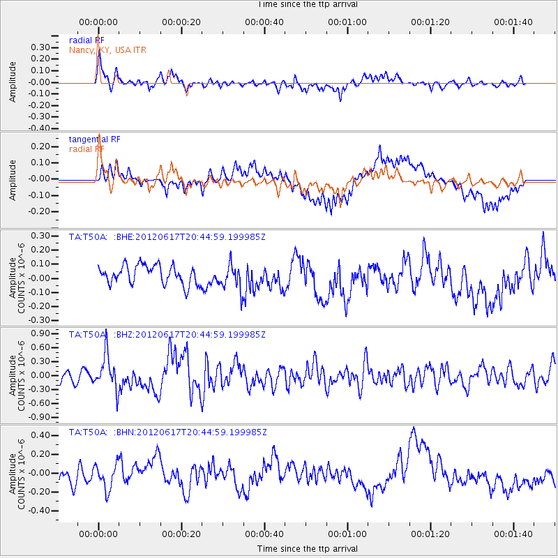
Earthquake location: Near East Coast Of Honshu, Japan
Earthquake latitude/longitude: 38.9/141.8
Earthquake time(UTC): 2012/06/17 (169) 20:32:20 GMT
Earthquake Depth: 36 km
Earthquake Magnitude: 6.0 MB, 5.9 MS, 6.3 MW, 6.4 MW
Earthquake Catalog/Contributor: WHDF/NEIC
Network: TA USArray Transportable Network (new EarthScope stations)
Station: T50A Nancy, KY, USA
Lat/Lon: 37.02 N/84.84 W
Elevation: 302 m
Distance: 93.1 deg
Az: 35.663 deg
Baz: 325.372 deg
Ray Param: 0.04132343
Estimated Moho Depth: 42.5 km
Estimated Crust Vp/Vs: 1.64
Assumed Crust Vp: 6.476 km/s
Estimated Crust Vs: 3.937 km/s
Estimated Crust Poisson's Ratio: 0.21
Radial Match: 80.07326 %
Radial Bump: 400
Transverse Match: 81.645164 %
Transverse Bump: 400
SOD ConfigId: 460165
Insert Time: 2013-02-11 21:37:56.820 +0000
GWidth: 2.5
Max Bumps: 400
Tol: 0.001

Signal To Noise

ChannelStoNSTALTA
TA:T50A: :BHZ:20120617T20:44:59.199985Z3.5830163.87847E-71.08245956E-7
TA:T50A: :BHN:20120617T20:44:59.199985Z1.90930121.3858299E-77.258309E-8
TA:T50A: :BHE:20120617T20:44:59.199985Z1.41133229.348661E-86.623998E-8
Arrivals
Ps4.3 SECOND
PpPs17 SECOND
PsPs/PpSs21 SECOND