You are here: Home > Network List > BK - Berkeley Digital Seismograph Network Stations List
> Station HUMO Hull Mountain, OR > Earthquake Result Viewer
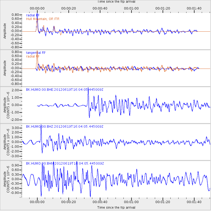
HUMO Hull Mountain, OR - Earthquake Result Viewer
*The percent match for this event was below the threshold and hence no stack was calculated.
| Earthquake location: |
Near Islands, Aleutian Islands |
| Earthquake latitude/longitude: |
53.4/171.6 |
| Earthquake time(UTC): |
2012/06/19 (171) 15:56:32 GMT |
| Earthquake Depth: |
14 km |
| Earthquake Magnitude: |
6.2 MB, 5.7 MS, 6.0 MW, 6.1 MW |
| Earthquake Catalog/Contributor: |
WHDF/NEIC |
|
| Network: |
BK Berkeley Digital Seismograph Network |
| Station: |
HUMO Hull Mountain, OR |
| Lat/Lon: |
42.61 N/122.96 W |
| Elevation: |
555 m |
|
| Distance: |
43.6 deg |
| Az: |
76.709 deg |
| Baz: |
307.79 deg |
| Ray Param: |
$rayparam |
*The percent match for this event was below the threshold and hence was not used in the summary stack. |
|
| Radial Match: |
76.32035 % |
| Radial Bump: |
368 |
| Transverse Match: |
71.80588 % |
| Transverse Bump: |
400 |
| SOD ConfigId: |
460165 |
| Insert Time: |
2013-02-11 21:45:28.867 +0000 |
| GWidth: |
2.5 |
| Max Bumps: |
400 |
| Tol: |
0.001 |
|
Signal To Noise
| Channel | StoN | STA | LTA |
| BK:HUMO:00:BHZ:20120619T16:04:05.445009Z | 6.515978 | 1.1922726E-6 | 1.8297678E-7 |
| BK:HUMO:00:BHN:20120619T16:04:05.445009Z | 3.2119937 | 4.753591E-7 | 1.4799502E-7 |
| BK:HUMO:00:BHE:20120619T16:04:05.445009Z | 7.7226214 | 8.210002E-7 | 1.0631108E-7 |
| Arrivals |
| Ps | |
| PpPs | |
| PsPs/PpSs | |


