
TUE Stuetta, Italy - Earthquake Result Viewer
| ||||||||||||||||||
| ||||||||||||||||||
| ||||||||||||||||||
|
Signal To Noise
| Channel | StoN | STA | LTA |
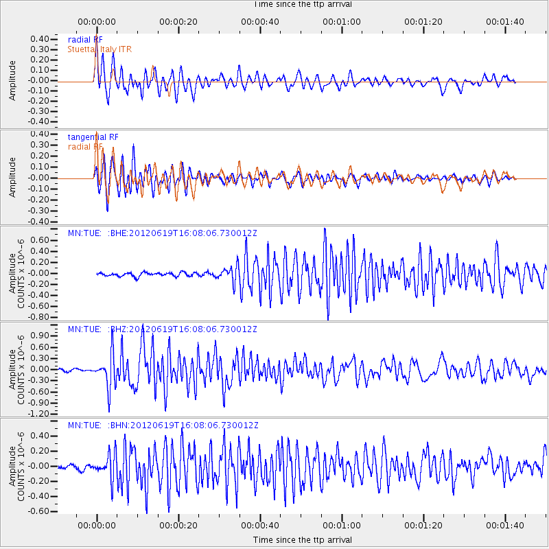
| MN:TUE: :BHZ:20120619T16:08:06.730012Z | 10.206309 | 4.4866056E-7 | 4.395914E-8 |
| MN:TUE: :BHN:20120619T16:08:06.730012Z | 6.8023477 | 1.6349594E-7 | 2.4035224E-8 |
| MN:TUE: :BHE:20120619T16:08:06.730012Z | 4.2509155 | 1.3749313E-7 | 3.234436E-8 |
| Arrivals | |
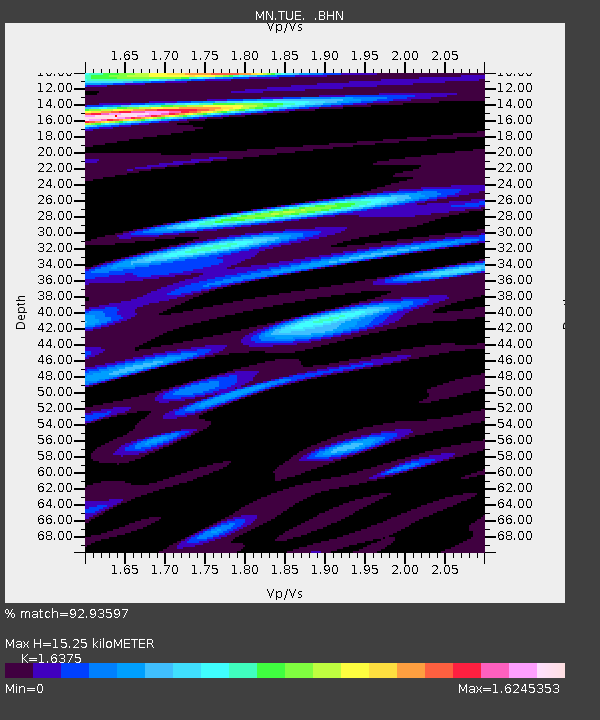
| Ps | 1.6 SECOND |
| PpPs | 6.1 SECOND |
| PsPs/PpSs | 7.6 SECOND |

