TIP Timpagrande, Italy - Earthquake Result Viewer
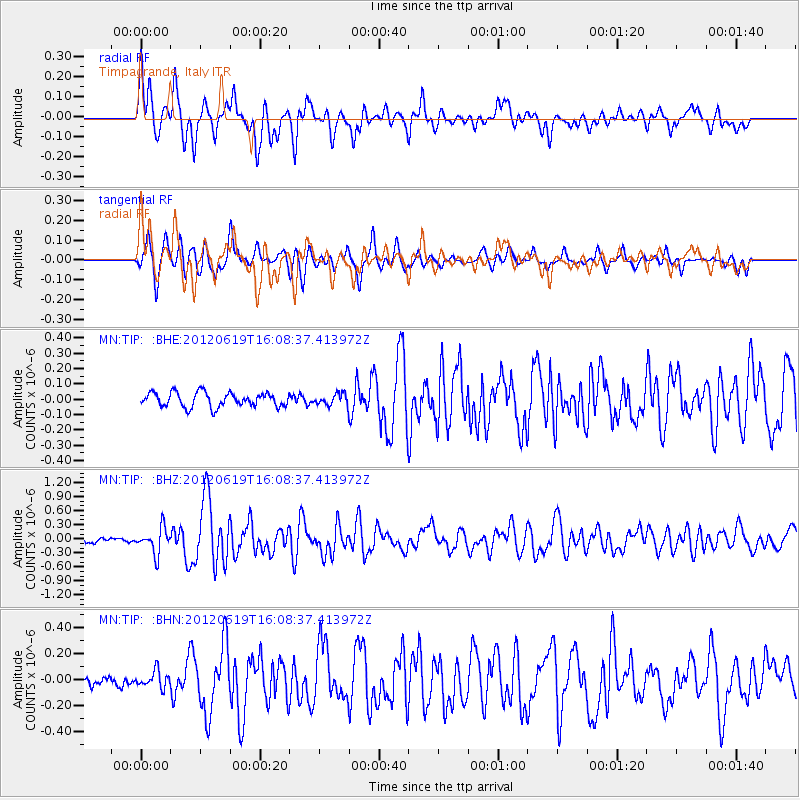
Earthquake location: Near Islands, Aleutian Islands
Earthquake latitude/longitude: 53.4/171.6
Earthquake time(UTC): 2012/06/19 (171) 15:56:32 GMT
Earthquake Depth: 14 km
Earthquake Magnitude: 6.2 MB, 5.7 MS, 6.0 MW, 6.1 MW
Earthquake Catalog/Contributor: WHDF/NEIC
Network: MN MEDNET Project
Station: TIP Timpagrande, Italy
Lat/Lon: 39.18 N/16.76 E
Elevation: 789 m
Distance: 85.3 deg
Az: 340.652 deg
Baz: 14.805 deg
Ray Param: 0.04485005
Estimated Moho Depth: 13.75 km
Estimated Crust Vp/Vs: 1.65
Assumed Crust Vp: 6.1 km/s
Estimated Crust Vs: 3.686 km/s
Estimated Crust Poisson's Ratio: 0.21
Radial Match: 88.86349 %
Radial Bump: 400
Transverse Match: 80.16117 %
Transverse Bump: 400
SOD ConfigId: 460165
Insert Time: 2013-02-11 21:56:24.935 +0000
GWidth: 2.5
Max Bumps: 400
Tol: 0.001

Signal To Noise

ChannelStoNSTALTA
MN:TIP: :BHZ:20120619T16:08:37.413972Z6.43272262.733624E-74.2495596E-8
MN:TIP: :BHN:20120619T16:08:37.413972Z1.75389786.5414724E-83.7296772E-8
MN:TIP: :BHE:20120619T16:08:37.413972Z0.789251863.6706613E-84.6508113E-8
Arrivals
Ps1.5 SECOND
PpPs5.8 SECOND
PsPs/PpSs7.4 SECOND