You are here: Home > Network List > NE - New England Seismic Network Stations List
> Station PQI Presque Isle, ME, USA > Earthquake Result Viewer
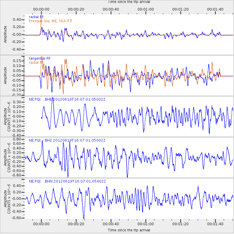
PQI Presque Isle, ME, USA - Earthquake Result Viewer
*The percent match for this event was below the threshold and hence no stack was calculated.
| Earthquake location: |
Near Islands, Aleutian Islands |
| Earthquake latitude/longitude: |
53.4/171.6 |
| Earthquake time(UTC): |
2012/06/19 (171) 15:56:32 GMT |
| Earthquake Depth: |
14 km |
| Earthquake Magnitude: |
6.2 MB, 5.7 MS, 6.0 MW, 6.1 MW |
| Earthquake Catalog/Contributor: |
WHDF/NEIC |
|
| Network: |
NE New England Seismic Network |
| Station: |
PQI Presque Isle, ME, USA |
| Lat/Lon: |
46.67 N/68.02 W |
| Elevation: |
162 m |
|
| Distance: |
68.2 deg |
| Az: |
39.794 deg |
| Baz: |
326.138 deg |
| Ray Param: |
$rayparam |
*The percent match for this event was below the threshold and hence was not used in the summary stack. |
|
| Radial Match: |
62.5456 % |
| Radial Bump: |
400 |
| Transverse Match: |
59.322147 % |
| Transverse Bump: |
400 |
| SOD ConfigId: |
460165 |
| Insert Time: |
2013-02-11 21:56:53.999 +0000 |
| GWidth: |
2.5 |
| Max Bumps: |
400 |
| Tol: |
0.001 |
|
Signal To Noise
| Channel | StoN | STA | LTA |
| NE:PQI: :BHZ:20120619T16:07:01.05002Z | 1.8344325 | 3.113898E-7 | 1.6974721E-7 |
| NE:PQI: :BHN:20120619T16:07:01.05002Z | 1.6847197 | 1.3875794E-7 | 8.236263E-8 |
| NE:PQI: :BHE:20120619T16:07:01.05002Z | 0.76359993 | 1.128177E-7 | 1.4774452E-7 |
| Arrivals |
| Ps | |
| PpPs | |
| PsPs/PpSs | |


