
MSTX Muleshoe, TX, USA - Earthquake Result Viewer
| ||||||||||||||||||
| ||||||||||||||||||
| ||||||||||||||||||
|
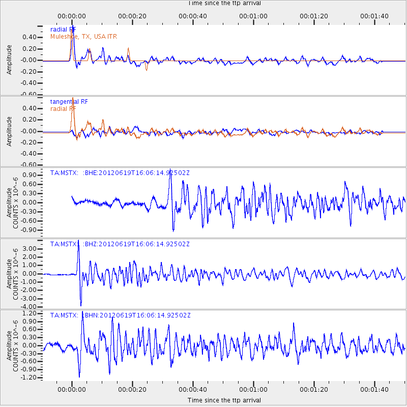
Signal To Noise
| Channel | StoN | STA | LTA |
| TA:MSTX: :BHZ:20120619T16:06:14.92502Z | 31.292265 | 1.5167828E-6 | 4.8471495E-8 |
| TA:MSTX: :BHN:20120619T16:06:14.92502Z | 5.466454 | 5.0622856E-7 | 9.2606385E-8 |
| TA:MSTX: :BHE:20120619T16:06:14.92502Z | 6.6939564 | 4.6778115E-7 | 6.988112E-8 |
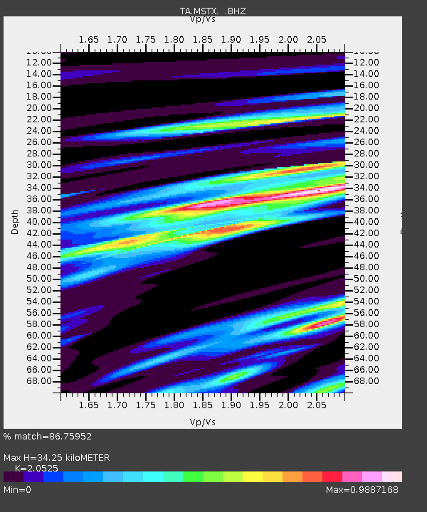
| Arrivals | |
| Ps | 6.1 SECOND |
| PpPs | 16 SECOND |
| PsPs/PpSs | 23 SECOND |

