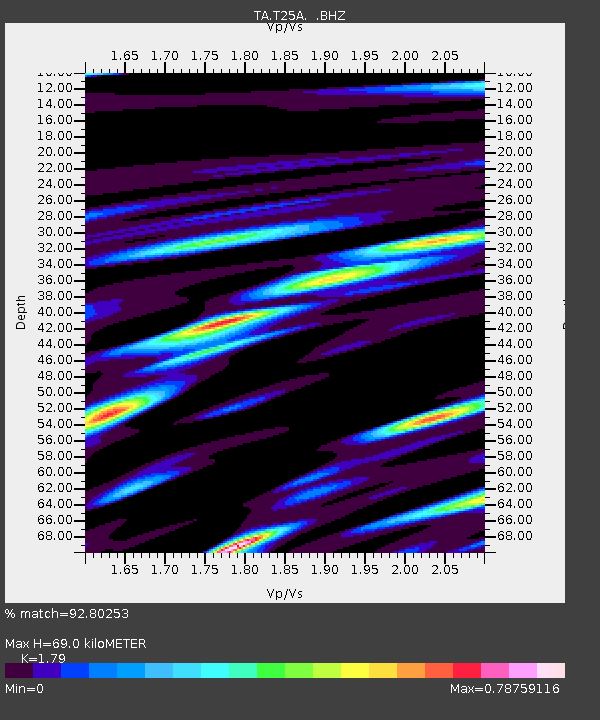
T25A Trinidad, CO, USA - Earthquake Result Viewer
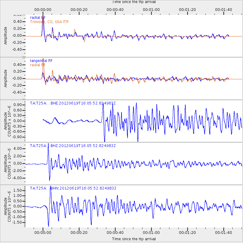
Earthquake location: Near Islands, Aleutian Islands
Earthquake latitude/longitude: 53.4/171.6
Earthquake time(UTC): 2012/06/19 (171) 15:56:32 GMT
Earthquake Depth: 14 km
Earthquake Magnitude: 6.2 MB, 5.7 MS, 6.0 MW, 6.1 MW
Earthquake Catalog/Contributor: WHDF/NEIC
Network: TA USArray Transportable Network (new EarthScope stations)
Station: T25A Trinidad, CO, USA
Lat/Lon: 37.14 N/104.41 W
Elevation: 2017 m
Distance: 57.9 deg
Az: 69.748 deg
Baz: 315.266 deg
Ray Param: 0.06318989
Estimated Moho Depth: 69.0 km
Estimated Crust Vp/Vs: 1.79
Assumed Crust Vp: 6.316 km/s
Estimated Crust Vs: 3.528 km/s
Estimated Crust Poisson's Ratio: 0.27
Radial Match: 92.80253 %
Radial Bump: 400
Transverse Match: 91.40077 %
Transverse Bump: 400
SOD ConfigId: 460165
Insert Time: 2013-02-11 22:00:41.467 +0000
GWidth: 2.5
Max Bumps: 400
Tol: 0.001

Signal To Noise

ChannelStoNSTALTA
TA:T25A: :BHZ:20120619T16:05:52.824983Z34.0427131.9537895E-65.7392295E-8
TA:T25A: :BHN:20120619T16:05:52.824983Z17.2786987.936498E-74.5932268E-8
TA:T25A: :BHE:20120619T16:05:52.824983Z5.67132764.5092585E-77.950975E-8
Arrivals
Ps9.0 SECOND
PpPs29 SECOND
PsPs/PpSs38 SECOND