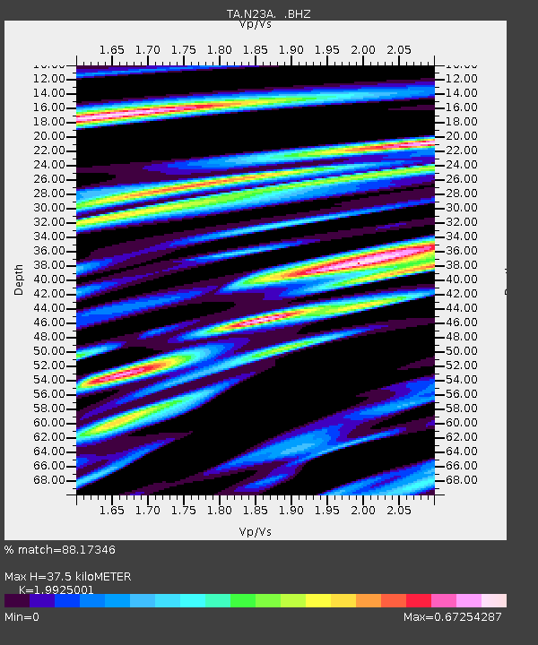
N23A Red Feather Lakes, CO, USA - Earthquake Result Viewer
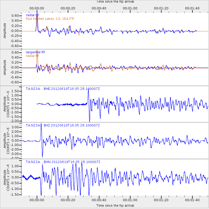
Earthquake location: Near Islands, Aleutian Islands
Earthquake latitude/longitude: 53.4/171.6
Earthquake time(UTC): 2012/06/19 (171) 15:56:32 GMT
Earthquake Depth: 14 km
Earthquake Magnitude: 6.2 MB, 5.7 MS, 6.0 MW, 6.1 MW
Earthquake Catalog/Contributor: WHDF/NEIC
Network: TA USArray Transportable Network (new EarthScope stations)
Station: N23A Red Feather Lakes, CO, USA
Lat/Lon: 40.89 N/105.94 W
Elevation: 2458 m
Distance: 54.4 deg
Az: 67.511 deg
Baz: 313.058 deg
Ray Param: 0.06544771
Estimated Moho Depth: 37.5 km
Estimated Crust Vp/Vs: 1.99
Assumed Crust Vp: 6.306 km/s
Estimated Crust Vs: 3.165 km/s
Estimated Crust Poisson's Ratio: 0.33
Radial Match: 88.17346 %
Radial Bump: 400
Transverse Match: 80.972084 %
Transverse Bump: 400
SOD ConfigId: 460165
Insert Time: 2013-02-11 22:00:54.542 +0000
GWidth: 2.5
Max Bumps: 400
Tol: 0.001

Signal To Noise

ChannelStoNSTALTA
TA:N23A: :BHZ:20120619T16:05:28.100007Z17.4794751.5249245E-68.7240856E-8
TA:N23A: :BHN:20120619T16:05:28.100007Z8.8518245.5587753E-76.279808E-8
TA:N23A: :BHE:20120619T16:05:28.100007Z10.7121237.547727E-77.045968E-8
Arrivals
Ps6.2 SECOND
PpPs17 SECOND
PsPs/PpSs23 SECOND