MDND Maddock, ND, USA - Earthquake Result Viewer
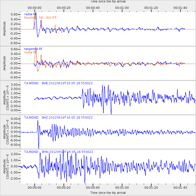
Earthquake location: Near Islands, Aleutian Islands
Earthquake latitude/longitude: 53.4/171.6
Earthquake time(UTC): 2012/06/19 (171) 15:56:32 GMT
Earthquake Depth: 14 km
Earthquake Magnitude: 6.2 MB, 5.7 MS, 6.0 MW, 6.1 MW
Earthquake Catalog/Contributor: WHDF/NEIC
Network: TA USArray Transportable Network (new EarthScope stations)
Station: MDND Maddock, ND, USA
Lat/Lon: 47.85 N/99.60 W
Elevation: 479 m
Distance: 53.1 deg
Az: 57.344 deg
Baz: 311.468 deg
Ray Param: 0.066305466
Estimated Moho Depth: 12.0 km
Estimated Crust Vp/Vs: 1.60
Assumed Crust Vp: 6.53 km/s
Estimated Crust Vs: 4.082 km/s
Estimated Crust Poisson's Ratio: 0.18
Radial Match: 93.89625 %
Radial Bump: 400
Transverse Match: 80.2639 %
Transverse Bump: 400
SOD ConfigId: 460165
Insert Time: 2013-02-11 22:01:06.280 +0000
GWidth: 2.5
Max Bumps: 400
Tol: 0.001

Signal To Noise

ChannelStoNSTALTA
TA:MDND: :BHZ:20120619T16:05:18.55002Z59.1958163.6811296E-66.2185634E-8
TA:MDND: :BHN:20120619T16:05:18.55002Z6.0714539.756267E-71.606908E-7
TA:MDND: :BHE:20120619T16:05:18.55002Z5.9256659.57992E-71.6166828E-7
Arrivals
Ps1.2 SECOND
PpPs4.5 SECOND
PsPs/PpSs5.7 SECOND